Approximate Location Map
Large Map »
Latitude: 51.2835 / 51°17'0"N
Longitude: 0.1489 / 0°8'56"E
OS Eastings: 549960
OS Northings: 156015
OS Grid: TQ499560
Mapcode National: GBR S9.S8S
Mapcode Global: VHHPK.JZLX
Plus Code: 9F3274MX+CH
Entry Name: Moat Farmhouse
Listing Date: 16 January 1975
Grade: II
Source: Historic England
Source ID: 1262281
English Heritage Legacy ID: 357003
ID on this website: 101262281
Location: Chipstead, Sevenoaks, Kent, TN13
County: Kent
District: Sevenoaks
Civil Parish: Chevening
Built-Up Area: Sevenoaks
Traditional County: Kent
Lieutenancy Area (Ceremonial County): Kent
Church of England Parish: Chevening St Botolph
Church of England Diocese: Rochester
Tagged with: Farmhouse
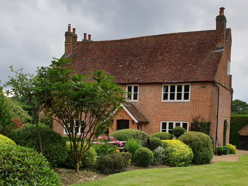
1.
5280 CHEVENING CHIPS
Homedean Road
(East Side)
Moat Farmhouse
5Q 4956 4/155
II
2.
Timber framed building probably of Cl6, with C18 red brick elevations. 2 storeys,
3 windows. Very steep tiled roof extended at left to 2 pairs of octagonal stacks.
Four-light Cl9 wood casements, some under segmental brick arches. Central projecting
brick porch.
Listing NGR: TQ4996056015
External links are from the relevant listing authority and, where applicable, Wikidata. Wikidata IDs may be related buildings as well as this specific building. If you want to add or update a link, you will need to do so by editing the Wikidata entry.


Other nearby listed buildings
