Latitude: 52.8571 / 52°51'25"N
Longitude: -0.9744 / 0°58'27"W
OS Eastings: 469155
OS Northings: 329333
OS Grid: SK691293
Mapcode National: GBR BMM.SKB
Mapcode Global: WHFJL.0G92
Plus Code: 9C4XV24G+R7
Entry Name: Stables Immediately North West of the Rectory
Listing Date: 25 September 1979
Grade: II
Source: Historic England
Source ID: 1265247
English Heritage Legacy ID: 425603
ID on this website: 101265247
Location: Hickling, Rushcliffe, Nottinghamshire, LE14
County: Nottinghamshire
District: Rushcliffe
Civil Parish: Hickling
Built-Up Area: Hickling
Traditional County: Nottinghamshire
Lieutenancy Area (Ceremonial County): Nottinghamshire
Church of England Parish: Hickling
Church of England Diocese: Southwell and Nottingham
Tagged with: Stable
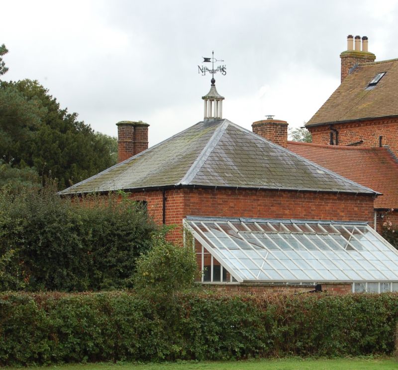
HICKLING MAIN STREET SK62NE (east side) 6/81 Stables immediately 25.9.79 north-west of The Rectory GV II Stable block. Early C19. Brick with slate roof. Square on plan. 3 ground-floor doorways and 2 windows plus 2 high level pitch-holes all with segmental head. Pyramidal roof with open octagonal lantern with pyramidal roof with ball finial and weather vane. To the right is a lower addition with a central stack with tall octagonal paired flues.
Listing NGR: SK6915529333
External links are from the relevant listing authority and, where applicable, Wikidata. Wikidata IDs may be related buildings as well as this specific building. If you want to add or update a link, you will need to do so by editing the Wikidata entry.


Other nearby listed buildings