Latitude: 54.5408 / 54°32'26"N
Longitude: -1.9247 / 1°55'29"W
OS Eastings: 404966
OS Northings: 516174
OS Grid: NZ049161
Mapcode National: GBR HH0Y.30
Mapcode Global: WHB4L.D4P8
Plus Code: 9C6WG3RG+84
Entry Name: Number 51 Including Arch and Part of Wall at Rear
Listing Date: 22 February 1973
Last Amended: 28 November 1994
Grade: II
Source: Historic England
Source ID: 1282721
English Heritage Legacy ID: 388830
ID on this website: 101282721
Location: Startforth, County Durham, DL12
County: County Durham
Civil Parish: Barnard Castle
Built-Up Area: Barnard Castle
Traditional County: Durham
Lieutenancy Area (Ceremonial County): County Durham
Church of England Parish: Barnard Castle with Whorlton
Church of England Diocese: Durham
Tagged with: Building
BARNARD CASTLE
NZ0416SE THE BANK 770-1/5/201 (West side (off)) 22/02/73 No.51 including arch and part of wall at rear (Formerly Listed as: THE BANK Old arch and portion of wall at rear of No.51)
GV II
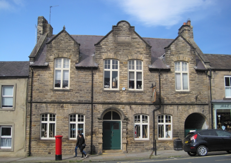
Formerly known as: No.51 St Mary's Mission Hall THE BANK. Mission Hall, now job centre. Dated 1901. For the parish of St Mary. C15 inscription and C16 arch in rear wall incorporated into 1901 building. Rock-faced stone with ashlar dressings; rear older rubble with eroded ashlar fragments; roof of Welsh slate with grey ridge tiles and stone gable copings and chimneys. EXTERIOR: 2 storeys; 3-window range. Round-headed vehicle arch at right with voussoirs. Recessed double doors and semicircular 2-pane overlight at left of second bay in surround of rusticated pilasters and segmental cornice. Low segmental heads with voussoirs to cross-casements with upper glazing bars: 2 in first bay, one to right of door, and one in third bay to left of vehicle arch. Taller windows in similar style on second floor, paired in centre, rise through eaves under gablets, the central shaped and containing inscription stone in gable peak. Roof has plain gable copings and end chimneys and central truncated lantern. Rear of vehicle passage has moulded segmental arch at left, above that the eroded inscription, and to right of that in first floor a fragment of carved stone apparently a beak-head string with head corbels. Fragment of stone. INTERIOR: not inspected. HISTORY: the ashlar inscription previously listed in isolation is described in Boyle's `Guide to the County of Durham' as being `in Surtees' day' set in an arch leading to the yard of a house in Thorngate' (the former name of The Bank), but in Boyle's time set in the rear of the house; these stones and another mentioned in the previous list supposedly read: `Ricardus/ Broun, Abbat cui a'i'e' p'picietur Deus'. According to Hutchinson the old house was perhaps the site of the Friary and Chapel founded in 1381 by the Austin Friars. (Boyle: The County of Durham: 1892-: 693-4; Clack: Archaeology in the North. App.A vi ... Barnard Castle: Durham: 1976-: 210).
Listing NGR: NZ0495916177
External links are from the relevant listing authority and, where applicable, Wikidata. Wikidata IDs may be related buildings as well as this specific building. If you want to add or update a link, you will need to do so by editing the Wikidata entry.


Other nearby listed buildings