Latitude: 51.9907 / 51°59'26"N
Longitude: -2.1607 / 2°9'38"W
OS Eastings: 389060
OS Northings: 232486
OS Grid: SO890324
Mapcode National: GBR 1JR.0KB
Mapcode Global: VH93T.H7K7
Plus Code: 9C3VXRRQ+7P
Entry Name: Russell Almshouses
Listing Date: 27 July 1973
Grade: II
Source: Historic England
Source ID: 1282761
English Heritage Legacy ID: 376736
ID on this website: 101282761
Location: Tewkesbury, Gloucestershire, GL20
County: Gloucestershire
District: Tewkesbury
Civil Parish: Tewkesbury
Built-Up Area: Tewkesbury
Traditional County: Gloucestershire
Lieutenancy Area (Ceremonial County): Gloucestershire
Church of England Parish: Tewkesbury St Mary the Virgin (Tewkesbury Abbey)
Church of England Diocese: Gloucester
Tagged with: Almshouse
TEWKESBURY
SO8932 CHURCH STREET, Abbey Precincts 859-1/6/378 (South side) 27/07/73 Russell Almshouses
GV II
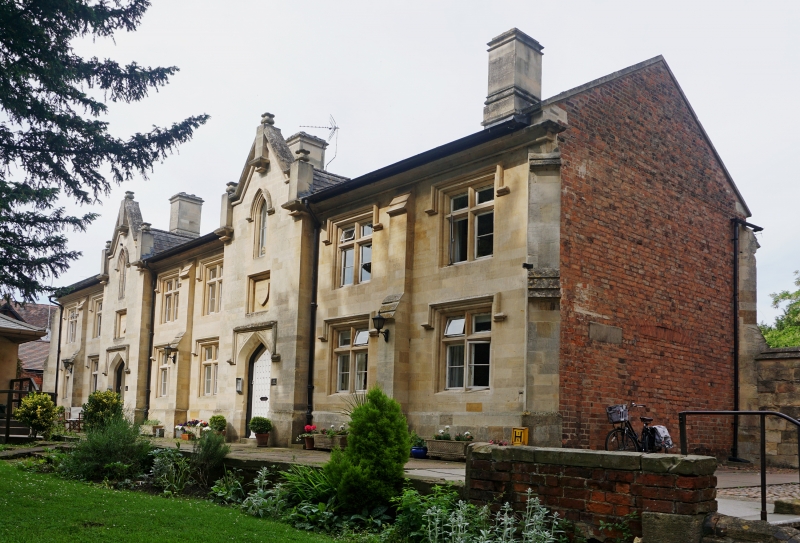
Almshouses. Founded 1674, rebuilt 1831, modernised 1958-1960 and re-instated 1989. Fine limestone ashlar front, brick returns and back, slate roof. Long narrow hipped block in 8 bays, brought forward to gable at bays 3 and 6, 2 storeys. 2:2:2-windowed, all double chamfer stone 2-light mullion and transom casements with stopped drip courses. In brought-forward bays plank and nail-head doors in 4-centred arch with decorative spandrels under drip course; above doorway sunk square panel with blank shield, and in gable small lancet with drip course under obelisk finial. Steep gable with moulded saddle coping and 3 finials. Full height buttresses to 2 offsets, diagonal at ends, and square between paired windows. 3 prominent stone stacks with moulded cappings. Deep plinth, deep eaves on cavetto mould. Ends are plain, with stone diagonal buttresses to outer corners, and back with flush surround simplified form of front fenestration; deeper window to stairs, opposite doorways. Well renovated for modern occupation, the various dates are inscribed in the front wall.
Listing NGR: SO8906432479
External links are from the relevant listing authority and, where applicable, Wikidata. Wikidata IDs may be related buildings as well as this specific building. If you want to add or update a link, you will need to do so by editing the Wikidata entry.


Other nearby listed buildings