Approximate Location Map
Large Map »
Latitude: 50.3296 / 50°19'46"N
Longitude: -4.7576 / 4°45'27"W
OS Eastings: 203830
OS Northings: 51381
OS Grid: SX038513
Mapcode National: GBR N1.XMR7
Mapcode Global: FRA 08X5.BBH
Plus Code: 9C2Q86HR+VX
Entry Name: Wall to Crinnis Cliff Gun Battery
Listing Date: 10 March 1992
Last Amended: 13 September 2018
Grade: II
Source: Historic England
Source ID: 1289512
English Heritage Legacy ID: 397008
ID on this website: 101289512
Location: Charlestown, Cornwall, PL25
County: Cornwall
Civil Parish: St Austell Bay
Built-Up Area: St Austell
Traditional County: Cornwall
Lieutenancy Area (Ceremonial County): Cornwall
Church of England Parish: Charlestown
Church of England Diocese: Truro
Tagged with: Wall
Wall to landward side of Crinnis Cliff gun battery, 1793 for Charles Rashleigh, with later alterations.
Wall to landward side of Crinnis Cliff gun battery, 1793 for Charles Rashleigh, with later alterations.
MATERIALS: stone rubble with granite parapet copings, later alterations in brick.
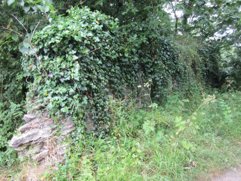
The landward defence to the Crinnis Cliff Battery roughly comprises a semi-circular wall, approximately two metres in height with a battlemented parapet with flat granite copings. At the south-west side is the original main entrance, altered with brick jambs and with a wrought-iron gate. Some areas of the internal face, particularly on the western side, are cement rendered marking the site of a lean-to storage facility for small arms. On the north-west side the wall has been breached. Within the battery there are remains of four gun platforms, a flag-staff base and bases for other ancillary buildings. Near the breached section of wall is a derelict brick and concrete ammunition magazine.
The village of Charlestown was developed from two farms, Higher and Lower Polmear, between 1792 and 1823 under the direction of Charles Rashleigh of Menabilly. The deep-water harbour, conceived by John Smeaton in 1792, was the focus of the principal industries in the area: copper, clay and pilchard fishing, exported to South Wales, Staffordshire and Catholic Mediterranean countries respectively. The harbour included a breakwater and outer harbour and an inner wet dock, and at the same time a seven-mile leat was constructed to bring in water from the Luxulyan Valley to fill the wet dock and scour the harbour.
Even before the establishment of Charlestown, the cliffs around St Austell Bay had been used as look-outs in times of war, with accounts recorded in 1720. From the C18 there was a real threat that troops from Holland, France or Spain would invade, and the coast was constantly watched. In 1793 Charles Rashleigh fully financed the construction of a cliff-top gun battery above Polmear Island, with the small cannon, shot and powder, and a regular army artillery sergeant provided by the Government. It was the only gun battery to be built specifically for a mineral port in Cornwall.
In 1795 the Crinnis Cliff Volunteers were formed as a single company under Captain John Peter and survived for over a century in various forms. These included a merger with the Cornish Artillery in 1800 (from when it was formally known as Crinnis Cliff Battery); and in 1805 when French invasion seemed imminent, the formation of the Crinnis Cliff Company of Volunteers which comprised solely men in Rashleigh’s employment, amounting to around 92 in number. At this time the cannon in the battery were four 18-pounder guns mounted on wooden garrison carriages. During bad weather and in the winter the guns were stored in a shed in the village (Grade II-listed). Called out by the fife and drum men, the Volunteers would drop their tools, change into their uniforms and load each gun onto a horse-drawn cart, or ‘dilly’. Scaling the hill to the battery - probably across the fields rather than by today’s coastal path - a large wooden door on the rear (west) side of the surrounding wall was opened, the cannon lowered onto rollers and then manhandled to the granite platform at the east of the battery. The process was repeated for each cannon, accompanied by all of the necessary equipment needed to load and fire the guns. Practice and competitive shoots were common, but the battery never fired a shot in defence, other than in 1840 when a British man o’war appeared in the bay with no ensign flying.
It is clear from historic mapping that the rear of the battery was defined by a defensive wall; it is shown on both the 1840s Tithe map and also a map of the Rashleigh estate of 1795. On the latter the rear entrance can clearly be seen as a break in the wall, with a small building against the inside of the wall. In 1861 the Volunteers became the No 4 Battery, Charlestown and its members were annually sent to Devonport, Plymouth for training. At about this time the original cannon were replaced with four 24-pounder guns; and again in 1884 for a single 32-pounder which was capable of significant damage to a wooden ship over a long range. It is likely that the battery was updated during this period to accommodate the new corps and artillery. By the time of the 1881 Ordnance Survey (OS) various small structures had been mapped within the battery enclosure, including one against the rear wall near the entrance. The gun platforms are shown at the south-east of the enclosure, and a central flagstaff labelled. The corps was disbanded in 1898 and the battery abandoned, although a flag may have remained flying as the staff appears on the 1907 OS. During the Second World War a look-out was mounted here; this was its last use. The battery has been in its current ownership since 1996 with a period of clearance and recording taking place in around 1998. In 2001 the site won a parish Civic Commendation for further conservation work at the site.
The wall to landward side of gun battery, 1793 for Charles Rashleigh, with later alterations is listed at Grade II for the following principal reasons:
Architectural interest:
* for its construction in local granite, with an ornamental parapet designed to be a feature in the landscape as seen from the Rashleigh estate at Duporth.
Historic interest:
* for the connection to Charles Rashleigh and the development of Charlestown from 1792;
* as a representation of defence against the threat of attack from the sea at the time of the Napoleonic Wars.
External links are from the relevant listing authority and, where applicable, Wikidata. Wikidata IDs may be related buildings as well as this specific building. If you want to add or update a link, you will need to do so by editing the Wikidata entry.


Other nearby listed buildings
