Latitude: 54.0499 / 54°2'59"N
Longitude: -2.8036 / 2°48'13"W
OS Eastings: 347481
OS Northings: 461842
OS Grid: SD474618
Mapcode National: GBR 8PVL.TZ
Mapcode Global: WH846.XG3N
Plus Code: 9C6V25XW+WG
Entry Name: 3, Castle Hill
Listing Date: 18 February 1970
Grade: II
Source: Historic England
Source ID: 1290858
English Heritage Legacy ID: 383064
ID on this website: 101290858
Location: Lancaster, Lancashire, LA1
County: Lancashire
District: Lancaster
Electoral Ward/Division: Castle
Parish: Non Civil Parish
Built-Up Area: Lancaster
Traditional County: Lancashire
Lieutenancy Area (Ceremonial County): Lancashire
Church of England Parish: Lancaster St Mary with St John and St Anne
Church of England Diocese: Blackburn
LANCASTER
SD4761NW CASTLE HILL 1685-1/6/31 (East side) 18/02/70 No.3
GV II
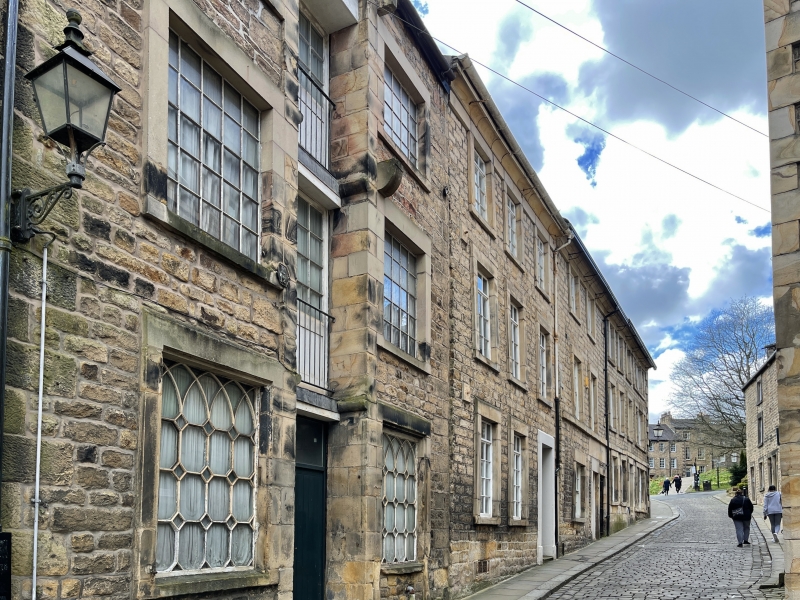
House, now consulting room. Mid C18, with C19 and C20 alterations. Coursed squared sandstone with some quoins to the right and ashlar dressings. Slate roof. Double-depth plan. 3 storeys above a cellar and 3 bays, with a prominent hollow-moulded eaves cornice and a timber gutter supported by slender iron brackets. The windows have raised plain surrounds and C20 glazing bar top-hung casements. The doorway is in the right-hand bay and has a painted raised plain surround and a recessed C19 twelve-panelled door up 2 steps with nosings. INTERIOR: open-string staircase with undecorated scrolled brackets, 2 turned balusters per tread, a ramped handrail and columnar newels, at the foot is a single Doric pilaster with a fluted shaft.
Listing NGR: SD4748261841
External links are from the relevant listing authority and, where applicable, Wikidata. Wikidata IDs may be related buildings as well as this specific building. If you want to add or update a link, you will need to do so by editing the Wikidata entry.


Other nearby listed buildings