Approximate Location Map
Large Map »
Latitude: 49.9148 / 49°54'53"N
Longitude: -6.3101 / 6°18'36"W
OS Eastings: 90695
OS Northings: 10535
OS Grid: SV906105
Mapcode National: GBR BXTX.6GC
Mapcode Global: VGYC4.KDYM
Plus Code: 8CXMWM7Q+WW
Entry Name: Gateway to West of the Chaplaincy
Listing Date: 14 December 1992
Grade: II
Source: Historic England
Source ID: 1291873
English Heritage Legacy ID: 62486
ID on this website: 101291873
Location: Hugh Town, Isles of Scilly, Cornwall, TR21
County: Isles of Scilly
Civil Parish: St. Mary's
Built-Up Area: Hugh town
Lieutenancy Area (Ceremonial County): Cornwall
Church of England Parish: Isles of Scilly
Church of England Diocese: Truro
Tagged with: Gate
ST. MARY'S
SV9010 CHURCH ROAD, Hugh Town
1358-0/8/46 (East side)
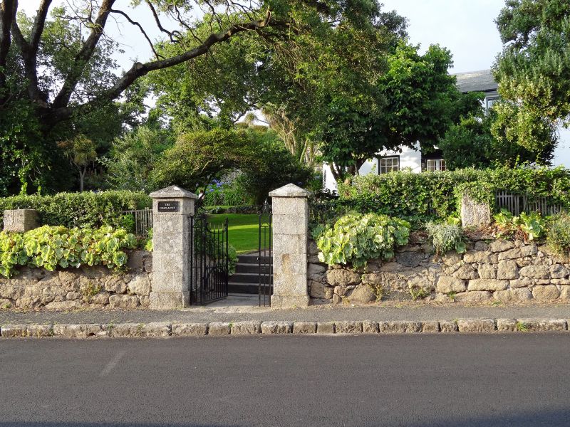
Gateway to W. of The Chaplaincy
GV II
Gateway. Early C19. Dressed granite piers with pyramidal caps
flank decorative wrought-iron gate. Included for group value.
Listing NGR: SV9069610536
External links are from the relevant listing authority and, where applicable, Wikidata. Wikidata IDs may be related buildings as well as this specific building. If you want to add or update a link, you will need to do so by editing the Wikidata entry.


Other nearby listed buildings
