Approximate Location Map
Large Map »
Latitude: 52.339 / 52°20'20"N
Longitude: -2.2791 / 2°16'44"W
OS Eastings: 381079
OS Northings: 271245
OS Grid: SO810712
Mapcode National: GBR 0C0.6MG
Mapcode Global: VH920.FGZT
Plus Code: 9C4V8PQC+H9
Entry Name: 14, York Street
Listing Date: 11 October 1991
Grade: II
Source: Historic England
Source ID: 1292612
English Heritage Legacy ID: 393391
ID on this website: 101292612
Location: Stourport-on-Severn, Wyre Forest, Worcestershire, DY13
County: Worcestershire
District: Wyre Forest
Civil Parish: Stourport-on-Severn
Built-Up Area: Stourport-on-Severn
Traditional County: Worcestershire
Lieutenancy Area (Ceremonial County): Worcestershire
Church of England Parish: Stourport-on-Severn and Wilden
Church of England Diocese: Worcester
Tagged with: Building
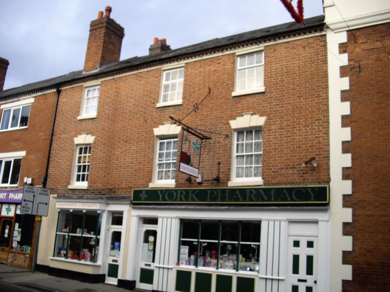
STOURPORT ON SEVERN
SO8171SW YORK STREET
589-1/9/73 (North side)
No.14
GV II
Shop, possibly originally dwelling. c1800. Brick with Welsh
slate roof. 3-storeyed, single unit plan, with early C20 shop
front with arcaded window and doorway to left beneath a single
fascia. Upper windows are 12-pane sashes with flat arched
stuccoed heads with voussoirs and keystones. Modillion eaves
cornice, gable end stacks.
Listing NGR: SO8107971245
External links are from the relevant listing authority and, where applicable, Wikidata. Wikidata IDs may be related buildings as well as this specific building. If you want to add or update a link, you will need to do so by editing the Wikidata entry.


Other nearby listed buildings
