Latitude: 54.9178 / 54°55'4"N
Longitude: -1.3794 / 1°22'45"W
OS Eastings: 439876
OS Northings: 558301
OS Grid: NZ398583
Mapcode National: GBR VD1.LZ
Mapcode Global: WHD55.SN98
Plus Code: 9C6WWJ9C+46
Entry Name: Vicarage to Church of All Saints
Listing Date: 17 October 1994
Grade: II
Source: Historic England
Source ID: 1293223
English Heritage Legacy ID: 391461
ID on this website: 101293223
Location: Monkwearmouth, Sunderland, Tyne and Wear, SR6
County: Sunderland
Electoral Ward/Division: St Peter's
Parish: Non Civil Parish
Built-Up Area: Sunderland
Traditional County: Durham
Lieutenancy Area (Ceremonial County): Tyne and Wear
Church of England Parish: Monkwearmouth Team Ministry
Church of England Diocese: Durham
Tagged with: Clergy house
SUNDERLAND
NZ35NE FULWELL ROAD 920-1/4/87 (West side) No.3 Vicarage to Church of All Saints
GV II
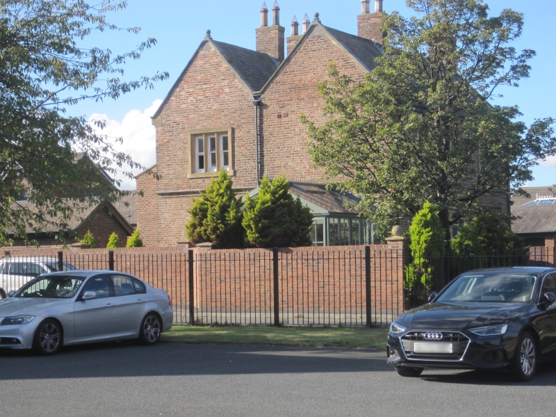
Vicarage to Church of All Saints (qv). c1849. By John Dobson. C17 style. Garden wall bond brick (5 and one) with ashlar plinth and painted ashlar dressings; Welsh slate roof with ashlar gable copings and brick chimneys. Parallel roof ridges. 2 storeys, 3 windows. Central door with Tudor-headed panels in plain painted stone surround has label dripmould; similar drip moulds over flanking 3-light stone mullion and transom windows and first-floor mullion windows of 3, 2 and 3 lights. Moulded plinth and first floor string. Roofs have ball finials to ashlar gable copings on moulded kneelers, and ridge and end brick chimneys with ashlar coping.
Listing NGR: NZ3987658301
External links are from the relevant listing authority and, where applicable, Wikidata. Wikidata IDs may be related buildings as well as this specific building. If you want to add or update a link, you will need to do so by editing the Wikidata entry.


Other nearby listed buildings