Latitude: 54.9123 / 54°54'44"N
Longitude: -1.3824 / 1°22'56"W
OS Eastings: 439694
OS Northings: 557684
OS Grid: NZ396576
Mapcode National: GBR VCM.R9
Mapcode Global: WHD55.QSXJ
Plus Code: 9C6WWJ69+W3
Entry Name: Wall Attached to North West
Listing Date: 10 November 1978
Grade: II
Source: Historic England
Source ID: 1279915
English Heritage Legacy ID: 391387
ID on this website: 101279915
Location: Monkwearmouth, Sunderland, Tyne and Wear, SR6
County: Sunderland
Electoral Ward/Division: St Peter's
Parish: Non Civil Parish
Built-Up Area: Sunderland
Traditional County: Durham
Lieutenancy Area (Ceremonial County): Tyne and Wear
Church of England Parish: Monkwearmouth Team Ministry
Church of England Diocese: Durham
Tagged with: Wall
SUNDERLAND
NZ3957 BARCLAY STREET 920-1/11/12 (South side) 10/11/78 No.57 and wall to north-west
GV II
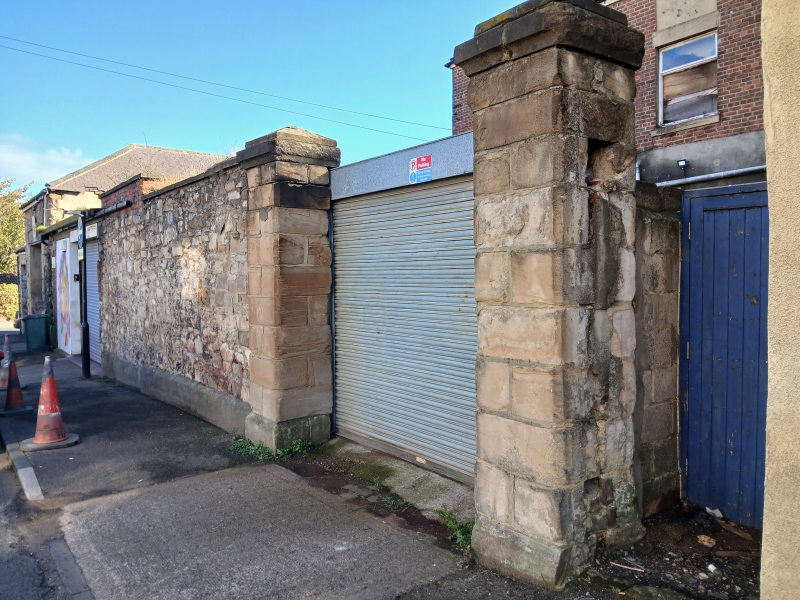
Stables and offices to No.58 (qv), now garage and house, with yard wall attached linking it to No.58. Early C19 with late C19 and C20 alterations. Rubble limestone left building with ashlar quoins has yard wall with ashlar coping and gate piers. House at rear of yard is brick with painted ashlar dressings, rendered ground floor and rubble rear elevation. Welsh slate roof on building at left and composition tile on rear house. North elevation to Barclay Street: one-storey, one-bay rubble building with high wall attached, the building now part of a garage with C20 metal garage door; yard wall with C20 sliding vehicle door. At right, adjacent to No.58, a pair of tall square ashlar gate piers with top bands and low pyramidal coping. Boarded gates. Hipped Welsh slate roof with grey ridge tiles runs back from left building. House at back of yard: 3 storeys, 4 windows, with wide segmental-arched vehicle entrance at left, details obscured by render. Renewed first-floor windows have flat stone lintels and projecting stone sills, and blind panels above which were probably second floor windows. Rear elevation to Cross Rendlesham Street: rubble with eroded floor bands, continuous with bands of No.58. Irregular fenestration; projecting stone sills to renewed windows.
Listing NGR: NZ3969457684
External links are from the relevant listing authority and, where applicable, Wikidata. Wikidata IDs may be related buildings as well as this specific building. If you want to add or update a link, you will need to do so by editing the Wikidata entry.


Other nearby listed buildings