Latitude: 52.9281 / 52°55'41"N
Longitude: -3.0621 / 3°3'43"W
OS Eastings: 328698
OS Northings: 337270
OS Grid: SJ286372
Mapcode National: GBR 73.MDPW
Mapcode Global: WH78C.YN0M
Plus Code: 9C4RWWHQ+65
Entry Name: Chirk Aqueduct
Listing Date: 2 September 1987
Grade: II*
Source: Historic England
Source ID: 1295150
English Heritage Legacy ID: 255822
ID on this website: 101295150
Location: Chirk Bank, Shropshire, LL14
County: Shropshire
Civil Parish: Weston Rhyn
Traditional County: Shropshire
Lieutenancy Area (Ceremonial County): Shropshire
Church of England Parish: Weston Rhyn St John
Church of England Diocese: Lichfield
WESTON RHYN C.P.
SJ 23 NE
1/108
SHROPSHIRE UNION CANAL
Chirk Aqueduct
GV
II*
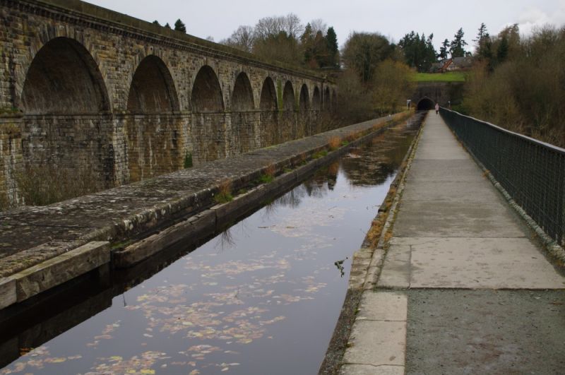
Canal aqueduct. 1796-1801 by William Jessop and Thomas Telford for the Ellesmere Canal. Roughly coursed limestone rubble with ashlar dressings and cast-iron railings to parapet on east side. Approximately 20 metres high with ten round-headed arches divided by pilaster strips; curving end walls to north and south. Arches have keystones and imposts struck through to soffit. Canal in trough with cast-iron bed and stone side walls. The aqueduct which cost £20,898 and was opened in 1801, spans the valley of the River Ceiriog and is partly in Wales, the border bisecting the structure at an angle of approximately 45° from south-west to north-east. Forms an impressive sight with the Chirk Viaduct (q.v.) running parallel immediately to west.
This entry was subject to a Minor Amendment on 25 October 2016.


Other nearby listed buildings