Approximate Location Map
Large Map »
Latitude: 51.6713 / 51°40'16"N
Longitude: 0.3859 / 0°23'9"E
OS Eastings: 565082
OS Northings: 199644
OS Grid: TQ650996
Mapcode National: GBR NJW.2F0
Mapcode Global: VHJKD.M8W3
Plus Code: 9F32M9CP+G9
Entry Name: Milepost Between Numbers 74 and 76
Listing Date: 9 December 1994
Grade: II
Source: Historic England
Source ID: 1297193
English Heritage Legacy ID: 373670
ID on this website: 101297193
Location: Ingatestone, Brentwood, Essex, CM4
County: Essex
District: Brentwood
Civil Parish: Ingatestone and Fryerning
Built-Up Area: Ingatestone
Traditional County: Essex
Lieutenancy Area (Ceremonial County): Essex
Church of England Parish: Ingatestone St Edmund and St Mary
Church of England Diocese: Chelmsford
Tagged with: Milestone
INGATESTONE AND FRYERNING
TQ6599 HIGH STREET, Ingatestone
723-1/14/397 (North West side)
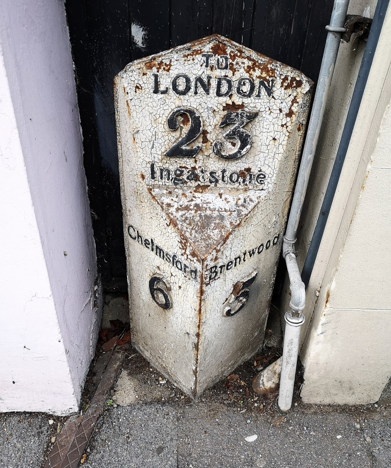
Milepost between Nos. 74 & 76
GV II
Milepost. Early-C19. Cast-iron. Triangular in plan, one vertical surface facing S embossed 'Chelmsford 6', one vertical surface facing E embossed 'Brentwood 5'. Chamfered back to a sloping surface above facing SE, embossed 'Ingatstone'. The road from Shenfield to Ingatestone was one of the first roads in Essex to be turnpiked, adopted by the Essex Trust in 1695. The erection of milestones was a statutory obligation from the 1760s. The previous milestone at this site is shown in Cary, l790, 48. This design in cast-iron was initiated by James McAdam, and was adopted by the Essex Trust in 1819 at the instigation of Lewis Majendie to avoid the frequent 'costs of re-cutting the inscriptions in limestone, and for greater clarity (Booker, 1974).
(Cary J: Survey of the High Roads from London: 1790-: 48; Booker J: Essex and the Industrial Revolution: 1974-: 101-116).
Listing NGR: TQ6508299644
External links are from the relevant listing authority and, where applicable, Wikidata. Wikidata IDs may be related buildings as well as this specific building. If you want to add or update a link, you will need to do so by editing the Wikidata entry.


Other nearby listed buildings
