Latitude: 53.2582 / 53°15'29"N
Longitude: -2.5164 / 2°30'58"W
OS Eastings: 365649
OS Northings: 373592
OS Grid: SJ656735
Mapcode National: GBR BZWR.0Q
Mapcode Global: WH99C.9CZJ
Plus Code: 9C5V7F5M+7F
Entry Name: Hayhurst Bridge over Weaver Navigation, and Control Cabin
Listing Date: 19 August 1986
Grade: II
Source: Historic England
Source ID: 1310259
English Heritage Legacy ID: 57625
ID on this website: 101310259
Location: Northwich, Cheshire West and Chester, Cheshire, CW8
County: Cheshire West and Chester
Civil Parish: Northwich
Built-Up Area: Northwich
Traditional County: Cheshire
Lieutenancy Area (Ceremonial County): Cheshire
Church of England Parish: Northwich St Luke
Church of England Diocese: Chester
Tagged with: Bridge Swing bridge
SJ 67 SE NORTHWICH C.P. CHESTER WAY
5/31 Hayhurst Bridge over Weaver Navigation, and Control Cabin
II
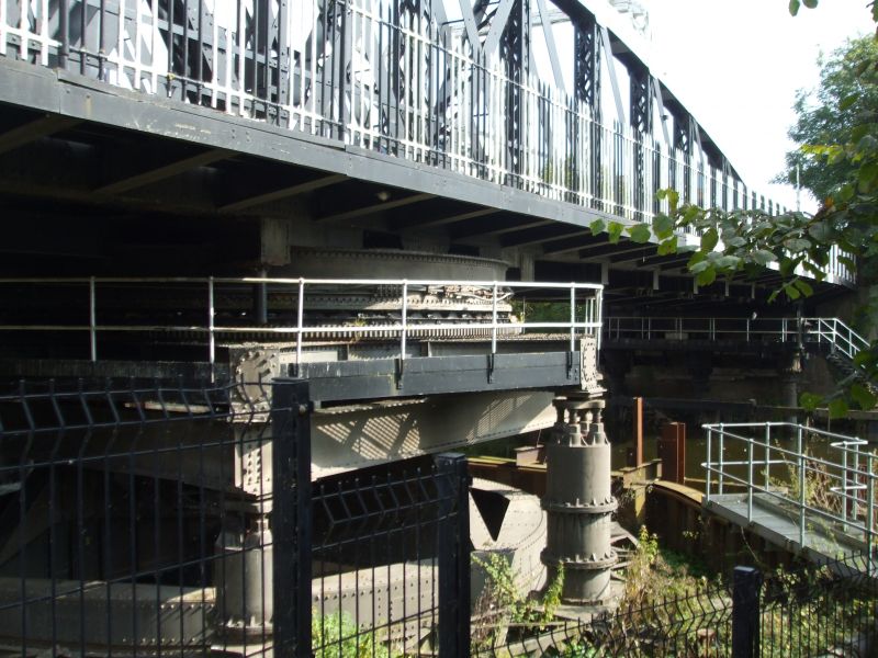
Swing bridge, 1899, steel, of one pivoted span with asymmetrical bowstring lattice girders; pivot on west bank of river. Steel double gates at each end on ornate cast iron posts. A cast iron plaque at west end of each girder is inscribed, in raised capitals, ERECTED BY THE WEAVER NAVIGATION TRUSTEES:1899: ENGINEER J A SANER M. INST. C.E: CONTRACTOR FOR METAL WORK A HANDYSIDE AND COMPANY LTD. DERBY AND LONDON.
Timber framed weatherboarded control cabin has oblique face to river and bridge, band of small-pane casements, pointed roof with ornate cast iron finial and wooden steps to river bank.
This and Baron's Quay Bridge (q.v.) are believed to be the earliest electrically powered swing bridges in Britain.
Listing NGR: SJ6564973592
External links are from the relevant listing authority and, where applicable, Wikidata. Wikidata IDs may be related buildings as well as this specific building. If you want to add or update a link, you will need to do so by editing the Wikidata entry.


Other nearby listed buildings