Latitude: 52.2496 / 52°14'58"N
Longitude: 0.7129 / 0°42'46"E
OS Eastings: 585286
OS Northings: 264736
OS Grid: TL852647
Mapcode National: GBR QDT.T7C
Mapcode Global: VHKD4.9QQB
Plus Code: 9F426PX7+R4
Entry Name: 51 and 52, St Johns Street
Listing Date: 2 November 1993
Grade: II
Source: Historic England
Source ID: 1313422
English Heritage Legacy ID: 467269
ID on this website: 101313422
Location: Bury St Edmunds, West Suffolk, IP33
County: Suffolk
District: West Suffolk
Civil Parish: Bury St Edmunds
Built-Up Area: Bury St Edmunds
Traditional County: Suffolk
Lieutenancy Area (Ceremonial County): Suffolk
Church of England Parish: Bury St Edmunds St John the Evangelist
Church of England Diocese: St.Edmundsbury and Ipswich
Tagged with: House
BURY ST EDMUNDS
TL8564NW ST JOHN'S STREET
639-1/3/605 (East side)
02/11/93 Nos.51 AND 52
GV II
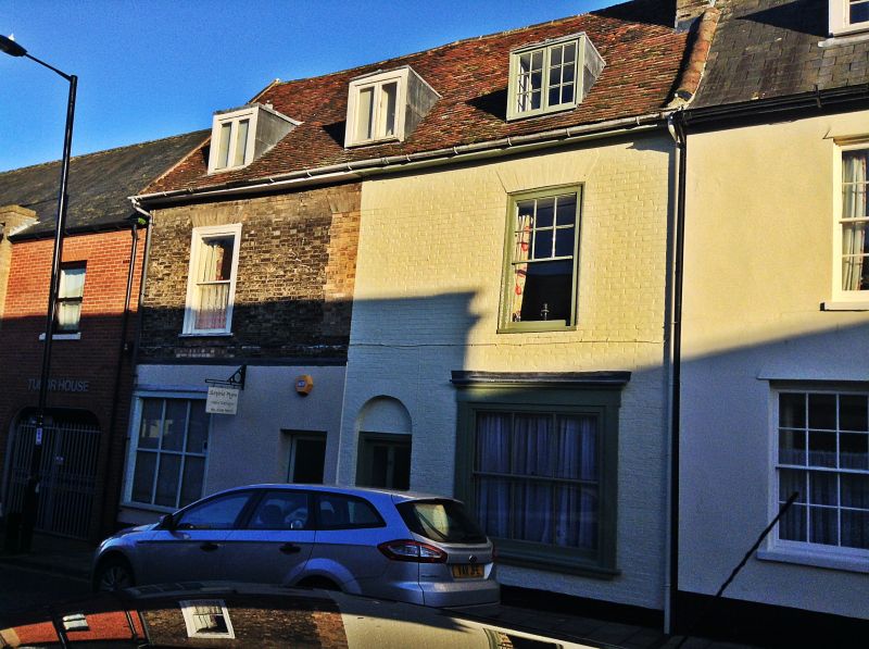
House. C16, divided into 2 houses in the early C19 with shops
along the frontage. Timber-framed; faced in random flint on
the upper storey with render to the ground storey; steeply
pitched plaintiled roof. Probably a basic L-plan.
EXTERIOR: 2 storeys and attics; two 12-pane sash windows to
the upper storey in flush cased frames with flat gauged arches
flank a blocked centre window. 3 flat lead-roofed dormers have
2-light small-paned casement windows.
On the ground storey, No.51 has a C20 door and shop window;
No.52 has an early C19 semicircular-headed doorway with a
half-glazed door and a 6-pane shop window with vertical
glazing bars in a surround with pilasters and cornice. The
rear of No.52 extends into a rendered wing; one long 20-pane
sash window in a flush cased frame on its north side.
INTERIOR: No.51 is said to have a modernised interior. No.52
is timber-framed throughout with the frame extending into the
rear wing. In 3 bays, but formerly with at least one more bay:
a fully chamfered and stopped beam is exposed in the rear
outer wall. On the upper storey, wallplates and main posts
visible.
The roof was raised to create a full attic storey, probably in
the C18, prior to dividing up and refronting the building. The
original open form of the wing suggests that it was designed
as a working and storage area initially.
Listing NGR: TL8528664736
External links are from the relevant listing authority and, where applicable, Wikidata. Wikidata IDs may be related buildings as well as this specific building. If you want to add or update a link, you will need to do so by editing the Wikidata entry.


Other nearby listed buildings