Latitude: 50.3343 / 50°20'3"N
Longitude: -4.7602 / 4°45'36"W
OS Eastings: 203662
OS Northings: 51908
OS Grid: SX036519
Mapcode National: GBR N1.X72X
Mapcode Global: FRA 08X4.WX0
Plus Code: 9C2Q86MQ+PW
Entry Name: 103, Charlestown Road
Listing Date: 11 March 1974
Grade: II
Source: Historic England
Source ID: 1327310
English Heritage Legacy ID: 70680
ID on this website: 101327310
Location: Charlestown, Cornwall, PL25
County: Cornwall
Civil Parish: St Austell Bay
Built-Up Area: St Austell
Traditional County: Cornwall
Lieutenancy Area (Ceremonial County): Cornwall
Church of England Parish: Charlestown
Church of England Diocese: Truro
Tagged with: Building
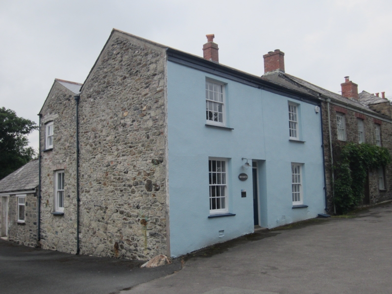
CHARLESTOWN
1. CHARLESTOWN ROAD
1584A (West Side)
No 103
SX 0351 NE 4/22
II GV
2.
Early C19. Stucco, 2 storeys. 2 sash windows With glazing bars. Central
panelled door with plain rectangular fanlight. Slate roof with gable
ends. Included for group value only.
Nos 93 to 109 (odd) form a group.
Listing NGR: SX0366251908
External links are from the relevant listing authority and, where applicable, Wikidata. Wikidata IDs may be related buildings as well as this specific building. If you want to add or update a link, you will need to do so by editing the Wikidata entry.


Other nearby listed buildings