Latitude: 50.3341 / 50°20'2"N
Longitude: -4.7599 / 4°45'35"W
OS Eastings: 203684
OS Northings: 51883
OS Grid: SX036518
Mapcode National: GBR N1.X755
Mapcode Global: FRA 08X4.X10
Plus Code: 9C2Q86MR+J2
Entry Name: 93-97, Charlestown Road
Listing Date: 11 March 1974
Grade: II
Source: Historic England
Source ID: 1144288
English Heritage Legacy ID: 70679
ID on this website: 101144288
Location: Charlestown, Cornwall, PL25
County: Cornwall
Civil Parish: St Austell Bay
Built-Up Area: St Austell
Traditional County: Cornwall
Lieutenancy Area (Ceremonial County): Cornwall
Church of England Parish: Charlestown
Church of England Diocese: Truro
Tagged with: Building
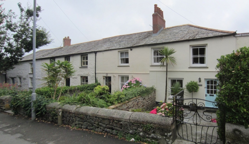
CHARLESTOWN
1. CHARLESTOWN ROAD
1584A (West Side)
Nos 93 to 97 (odd)
SX 0351 NE 4/20
II GV
2.
Late C18/early C19 cottages. Colourwashed rubble and cob. 2 storeys.
Seven windows overall (one blocked) irregularly spaced sashes without
glazing bars. Glazed doors. Slate hipped roof. Included for group value only.
Nos 93 to 109 (odd) form a group.
Listing NGR: SX0368451883
External links are from the relevant listing authority and, where applicable, Wikidata. Wikidata IDs may be related buildings as well as this specific building. If you want to add or update a link, you will need to do so by editing the Wikidata entry.


Other nearby listed buildings