Latitude: 52.9608 / 52°57'38"N
Longitude: -1.15 / 1°8'59"W
OS Eastings: 457193
OS Northings: 340715
OS Grid: SK571407
Mapcode National: GBR LPL.4S
Mapcode Global: WHDGS.9VM2
Plus Code: 9C4WXV62+82
Entry Name: 96 to 108, Mansfield Road
Listing Date: 13 July 1988
Grade: II
Source: Historic England
Source ID: 1344934
English Heritage Legacy ID: 457885
ID on this website: 101344934
Location: Nottingham, Nottinghamshire, NG1
County: City of Nottingham
Electoral Ward/Division: St Ann's
Parish: Non Civil Parish
Built-Up Area: Nottingham
Traditional County: Nottinghamshire
Lieutenancy Area (Ceremonial County): Nottinghamshire
Church of England Parish: Nottingham St Andrew
Church of England Diocese: Southwell and Nottingham
Tagged with: Building
NOTTINGHAM
SK5740NW MANSFIELD ROAD 646-1/11/372 (East side) 13/07/88 Nos.96-108 (Even)
GV II
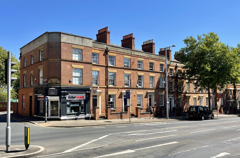
Terrace of 8 town houses, now offices and shop. c1840, restored late C20. Red brick with painted stucco dressings and slate roofs with 7 large ridge stacks. Plinth, sill bands to upper floors, rendered coped parapet. 3 storeys; 15 bays. The terrace is stepped uphill in the centre, and has projecting end bays. Windows are mainly original glazing bar sashes, with wedge lintels. Ground floor has moulded stucco doorcases with flat hoods on brackets, alternating with windows. Moulded 4-panel doors, mostly renewed. Upper floors have regular fenestration, mostly original, with smaller second floor windows. Left end bay has a recessed rounded corner with a doorway flanked by single shop windows on each front. Mainly renewed wooden shopfront with pilasters, and cornice on scroll brackets. Over the door, remains of a crest. Left return has 3 windows of various sizes.
Listing NGR: SK5719340715
External links are from the relevant listing authority and, where applicable, Wikidata. Wikidata IDs may be related buildings as well as this specific building. If you want to add or update a link, you will need to do so by editing the Wikidata entry.


Other nearby listed buildings