Latitude: 51.9967 / 51°59'48"N
Longitude: -2.1552 / 2°9'18"W
OS Eastings: 389438
OS Northings: 233150
OS Grid: SO894331
Mapcode National: GBR 1JK.V7S
Mapcode Global: VH93T.L2GN
Plus Code: 9C3VXRWV+MW
Entry Name: 70, High Street
Listing Date: 4 March 1952
Grade: II
Source: Historic England
Source ID: 1355128
English Heritage Legacy ID: 376813
ID on this website: 101355128
Location: Tewkesbury, Gloucestershire, GL20
County: Gloucestershire
District: Tewkesbury
Civil Parish: Tewkesbury
Built-Up Area: Tewkesbury
Traditional County: Gloucestershire
Lieutenancy Area (Ceremonial County): Gloucestershire
Church of England Parish: Tewkesbury St Mary the Virgin (Tewkesbury Abbey)
Church of England Diocese: Gloucester
Tagged with: Building
TEWKESBURY
SO8933 HIGH STREET 859-1/5/230 (East side) 04/03/52 No.70
GV II
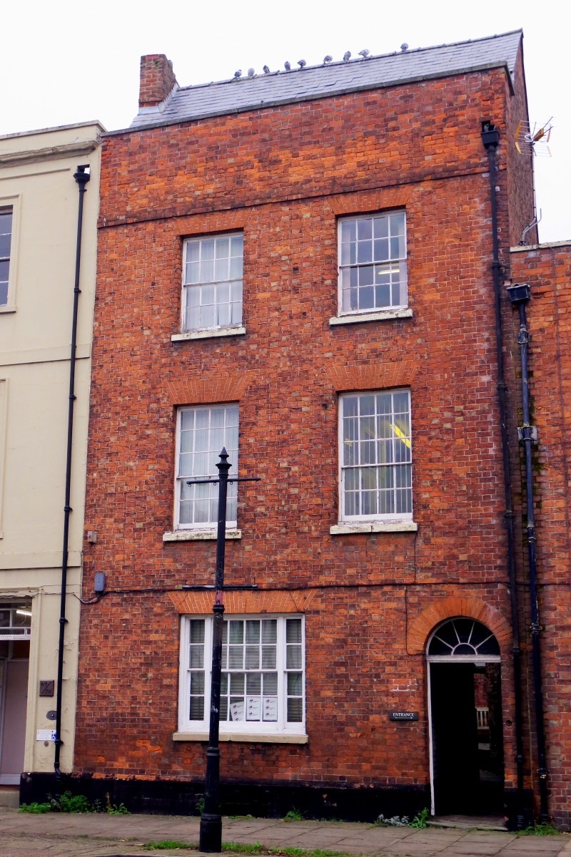
In same ownership as No.69 (qv). House in row. Early C19. Flemish bond brickwork, slate or asbestos-cement slate roof. L plan: parapeted front to street, mansard roof, 2 lower wings at angle to back. 3 storeys attic and basement, 2-windowed. 16 above 20-pane sashes to fine brick voussoirs and stooled stone cills. Ground floor has one tripartite sash with bars, above small opening to basement, and arched doorway to right with fanlight over flush panelled door; this gives to through passage to alley. Brick string course above second floor windows, and very high brick parapet to concrete coping. Back includes mansard-roofed wing, with lancet at ground floor, and a second, lower gabled wing with central 2-light casements to cambered brick arches. INTERIOR not inspected.
Listing NGR: SO8945033151
External links are from the relevant listing authority and, where applicable, Wikidata. Wikidata IDs may be related buildings as well as this specific building. If you want to add or update a link, you will need to do so by editing the Wikidata entry.


Other nearby listed buildings