Latitude: 51.9965 / 51°59'47"N
Longitude: -2.1554 / 2°9'19"W
OS Eastings: 389428
OS Northings: 233123
OS Grid: SO894331
Mapcode National: GBR 1JK.V6K
Mapcode Global: VH93T.L2DV
Plus Code: 9C3VXRWV+HR
Entry Name: 74, High Street
Listing Date: 4 March 1952
Grade: II
Source: Historic England
Source ID: 1025093
English Heritage Legacy ID: 376817
ID on this website: 101025093
Location: Tewkesbury, Gloucestershire, GL20
County: Gloucestershire
District: Tewkesbury
Civil Parish: Tewkesbury
Built-Up Area: Tewkesbury
Traditional County: Gloucestershire
Lieutenancy Area (Ceremonial County): Gloucestershire
Church of England Parish: Tewkesbury St Mary the Virgin (Tewkesbury Abbey)
Church of England Diocese: Gloucester
Tagged with: Building
TEWKESBURY
SO8933 HIGH STREET 859-1/5/234 (East side) 04/03/52 No.74
GV II
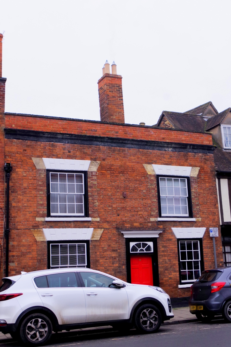
House in row. C18 or earlier, early C19 sashes. Flemish bond brickwork, tile roof, brick stacks. Central-entry parallel plan: a parapeted front but to small vertical scale, suggesting earlier fabric; some timber-framing remains back left. 2 storeys, 2-windowed. 16-pane sashes to first floor, C20 light and 12-pane, ground floor, all to wide V-joint lintels, but the 3 larger windows were formerly approx 330mm wider each side of the opening, now to straight joints. Off-centre right a 6-panel fielded door under a timber 'plate tracery' fanlight, all in pilaster surround to moulded cornice. Painted stone cornice, blocking in later brickwork, lofty brick stacks to right and left. INTERIOR not inspected.
Listing NGR: SO8942833123
External links are from the relevant listing authority and, where applicable, Wikidata. Wikidata IDs may be related buildings as well as this specific building. If you want to add or update a link, you will need to do so by editing the Wikidata entry.


Other nearby listed buildings