Latitude: 52.2516 / 52°15'5"N
Longitude: 0.7159 / 0°42'57"E
OS Eastings: 585487
OS Northings: 264962
OS Grid: TL854649
Mapcode National: GBR QDT.V42
Mapcode Global: VHKD4.CNBT
Plus Code: 9F427P28+J9
Entry Name: 79, Northgate Street
Listing Date: 12 July 1972
Grade: II
Source: Historic England
Source ID: 1365764
English Heritage Legacy ID: 467020
ID on this website: 101365764
Location: Bury St Edmunds, West Suffolk, IP33
County: Suffolk
District: West Suffolk
Civil Parish: Bury St Edmunds
Built-Up Area: Bury St Edmunds
Traditional County: Suffolk
Lieutenancy Area (Ceremonial County): Suffolk
Church of England Parish: Bury St Edmunds St John the Evangelist
Church of England Diocese: St.Edmundsbury and Ipswich
Tagged with: Building
BURY ST EDMUNDS
TL8564NW NORTHGATE STREET 639-1/3/494 (West side) 12/07/72 No.79
GV II
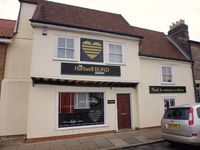
House, now shop. c1600. Timber-framed and roughcast rendered; plaintiled roof. EXTERIOR: part jettied with 2 storeys and attic; part lower, unjettied, of 2 storeys. A one-and-a-half storey lean-to along the back. The northern half has the jetty supported by small solid brackets. 2 upper sash windows with a single vertical glazing-bar to lights in a flush cased frame; a plate glass shop window to the ground storey with the entrance door to one side of it in a plain wood surround. The lower unjettied southern half has one sash window to each storey with single vertical glazing-bars in a flush cased frame. INTERIOR: no cellar. No visible structure on the ground storey. The rear wall has been removed but 2 main posts remain encased in tiled pillars. On the upper storey these posts have long jowled heads and formerly had arched braces. The upper ceiling in the south end is very low and cuts across the line of the sash window. Roofs not inspected.
Listing NGR: TL8548764962
External links are from the relevant listing authority and, where applicable, Wikidata. Wikidata IDs may be related buildings as well as this specific building. If you want to add or update a link, you will need to do so by editing the Wikidata entry.


Other nearby listed buildings