Latitude: 53.311 / 53°18'39"N
Longitude: -1.4573 / 1°27'26"W
OS Eastings: 436254
OS Northings: 379475
OS Grid: SK362794
Mapcode National: GBR LZ84.9T
Mapcode Global: WHDF2.L17K
Plus Code: 9C5W8G6V+93
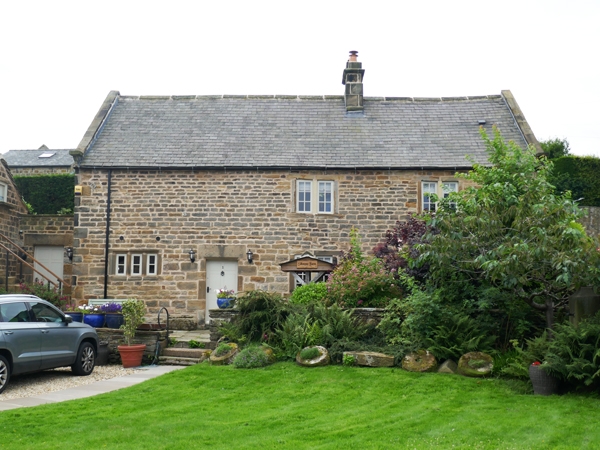
Entry Name: Silkstone Farmhouse
Listing Date: 7 July 1989
Grade: II
Source: Historic England
Source ID: 1370020
English Heritage Legacy ID: 79535
ID on this website: 101370020
Location: Coal Aston, North East Derbyshire, S18
County: Derbyshire
District: North East Derbyshire
Civil Parish: Dronfield
Built-Up Area: Dronfield
Traditional County: Derbyshire
Lieutenancy Area (Ceremonial County): Derbyshire
Church of England Parish: Dronfield St John Baptist
Church of England Diocese: Derby
Tagged with: Farmhouse
PARISH OF DRONFIELD STONE ROAD SK 37 NE 6/54 Silkstone Farmhouse GV II House. Early C17, with alterations in C18 and C19. Coursed coal measures sandstone with quoins, coped gables with moulded kneelers and ashlar ridge stacks, together with a square brick stack to the rear slope. Welsh slate with stone slated eaves. North elevation. Two storeys, three bays, off-centre doorway with chamfered quoined surround and lintel, and six panel door. To the east a low 3-light recessed chamfer mullioned window, to the west former flush mullioned windows now with C20 casements. The most westerly opening further altered, with a deep lintel and no jambs. Rear elevation has two 3-light flush mullioned windows, one partially blocked. To the west, the stump of a gabled linking range which formerly occupied the frontage to Stone Road, now with an exposed cruck truss with a collar beam and yoke.
Listing NGR: SK3625479475
External links are from the relevant listing authority and, where applicable, Wikidata. Wikidata IDs may be related buildings as well as this specific building. If you want to add or update a link, you will need to do so by editing the Wikidata entry.


Other nearby listed buildings