Latitude: 53.1903 / 53°11'25"N
Longitude: -2.8974 / 2°53'50"W
OS Eastings: 340135
OS Northings: 366293
OS Grid: SJ401662
Mapcode National: GBR 79.34NX
Mapcode Global: WH88F.G2HJ
Plus Code: 9C5V54R3+42
Entry Name: 12, Stanley Place
Listing Date: 28 July 1955
Last Amended: 6 August 1998
Grade: II
Source: Historic England
Source ID: 1376412
English Heritage Legacy ID: 470408
ID on this website: 101376412
Location: Chester, Cheshire West and Chester, Cheshire, CH1
County: Cheshire West and Chester
Electoral Ward/Division: Chester City
Parish: Non Civil Parish
Built-Up Area: Chester
Traditional County: Cheshire
Lieutenancy Area (Ceremonial County): Cheshire
Church of England Parish: Chester St John the Baptist
Church of England Diocese: Chester
Tagged with: Building
CHESTER CITY (IM)
SJ4066SW STANLEY PLACE 595-1/3/372 (North side) 28/07/55 No.12 (Formerly Listed as: STANLEY PLACE Nos 1-9 (consec), No 10 & Nos 11-14 (consec))
GV II
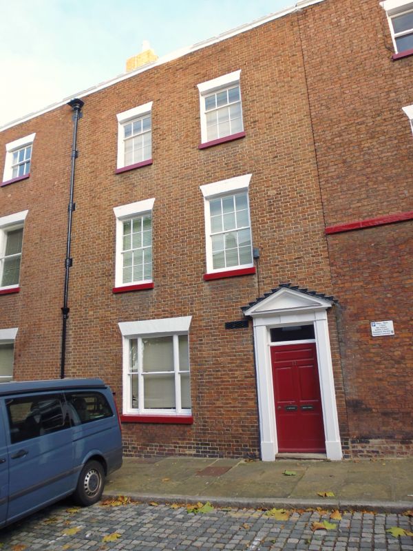
Town house. 1780. Flemish bond brown brick with grey slate roof. 3 storeys with roof hipped upward behind ridge to accommodate rear attic. One stone step to door of 5 fielded panels, the top panel being broad, under a plain overlight in a doorcase with plain pilasters and pediment with key; a recessed triple sash to first storey with glazing bars removed, 2 recessed 12-pane sashes to second storey and 2 recessed 9-pane sashes to third storey; stooled painted stone sills; slightly cambered painted gauged brick heads; painted stone cornice similar to those of Nos 2-10 and No.14 (qv); ornate rainwater head dated 1780, with lower part of pipe renewed. INTERIOR could not be inspected.
Listing NGR: SJ4014066296
External links are from the relevant listing authority and, where applicable, Wikidata. Wikidata IDs may be related buildings as well as this specific building. If you want to add or update a link, you will need to do so by editing the Wikidata entry.


Other nearby listed buildings