Latitude: 51.2109 / 51°12'39"N
Longitude: -2.6468 / 2°38'48"W
OS Eastings: 354912
OS Northings: 145940
OS Grid: ST549459
Mapcode National: GBR MN.3WSD
Mapcode Global: VH89S.2TKM
Plus Code: 9C3V6963+97
Entry Name: 5, New Street
Listing Date: 12 November 1953
Grade: II
Source: Historic England
Source ID: 1383036
English Heritage Legacy ID: 483454
ID on this website: 101383036
Location: Wells, Somerset, BA5
County: Somerset
District: Mendip
Civil Parish: Wells
Built-Up Area: Wells
Traditional County: Somerset
Lieutenancy Area (Ceremonial County): Somerset
Tagged with: Building
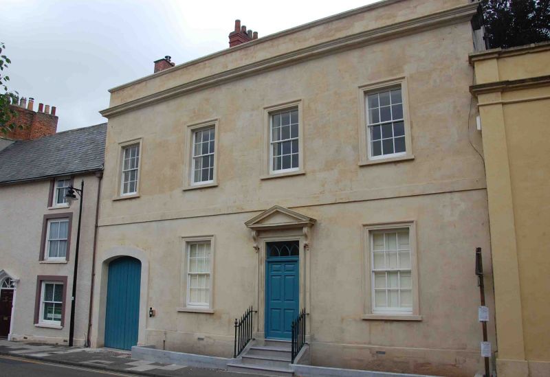
WELLS
ST5445 NEW STREET
662-1/7/172 (West side)
12/11/53 No.5
GV II
Former house, now bank and offices. C18. Doulting ashlar
stonework, Welsh slate roof between coped gables, brick
chimney stacks.
EXTERIOR: 2 storeys, 4 bays. Plinth, band course, cornice,
plain parapet. Ground floor modified, with 6-panel door under
rectangular fanlight in architrave to bay 1, C20 casements in
widened openings with stone architraves to bays 2 and 4, and
bay 3 has a 6-panelled entrance door, up 4 steps, with
rectangular 'Y' traceried fanlight and set in eaved architrave
with pediment hood on console brackets, C18 wrought-iron
railings to steps. First floor has 12-pane sash windows in
architraves. C20 hanging sign to right of bay 4.
INTERIOR: not inspected.
Listing NGR: ST5491245940
External links are from the relevant listing authority and, where applicable, Wikidata. Wikidata IDs may be related buildings as well as this specific building. If you want to add or update a link, you will need to do so by editing the Wikidata entry.


Other nearby listed buildings