Approximate Location Map
Large Map »
Latitude: 54.2683 / 54°16'5"N
Longitude: -2.3452 / 2°20'42"W
OS Eastings: 377617
OS Northings: 485903
OS Grid: SD776859
Mapcode National: GBR DM22.2P
Mapcode Global: WH94D.YZF7
Plus Code: 9C6V7M93+8W
Entry Name: Artengill Viaduct
Listing Date: 18 October 1999
Grade: II
Source: Historic England
Source ID: 1383817
English Heritage Legacy ID: 484249
ID on this website: 101383817
Location: Stone House, Westmorland and Furness, Cumbria, LA10
County: Cumbria
District: South Lakeland
Civil Parish: Dent
Traditional County: Yorkshire
Lieutenancy Area (Ceremonial County): Cumbria
Church of England Parish: Dent with Cowgill
Church of England Diocese: Carlisle
Tagged with: Viaduct
DENT
SD78NE DENTDALE
162-1/12/15 (North side)
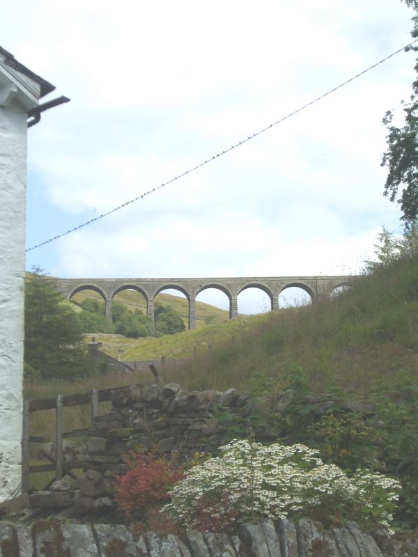
Artengill Viaduct
GV II
Railway viaduct carrying Settle to Carlisle railway line over
Artengill Beck. c1869-75, for the Midland Railway Company;
Chief Engineer John Crossley, resident engineer J.Underwood.
Rock-faced sandstone in massive blocks, with brick soffits to
the arches. Straight line on almost north-south axis. Eleven
round-headed arches on battered rectangular piers, those to
north and south of the 7th, 8th and 9th (which span the
deepest part of the valley) broader than the others and with
tapered pilasters; short cavetto-moulded imposts at the
springing of the arches, rusticated voussoirs, a moulded
string course and parapets with rounded coping. Matches Dent
Head Viaduct (qv) approx. 1200m to south. A striking feature
of the landscape.
Listing NGR: SD7761785903
External links are from the relevant listing authority and, where applicable, Wikidata. Wikidata IDs may be related buildings as well as this specific building. If you want to add or update a link, you will need to do so by editing the Wikidata entry.


Other nearby listed buildings
