Latitude: 51.4907 / 51°29'26"N
Longitude: -0.0885 / 0°5'18"W
OS Eastings: 532804
OS Northings: 178588
OS Grid: TQ328785
Mapcode National: GBR SM.8T
Mapcode Global: VHGR0.FS2M
Plus Code: 9C3XFWR6+7J
Entry Name: English Martyrs Primary School
Listing Date: 27 September 1972
Last Amended: 17 September 1998
Grade: II
Source: Historic England
Source ID: 1385527
English Heritage Legacy ID: 470926
ID on this website: 101385527
Location: Walworth, Southwark, London, SE17
County: London
District: Southwark
Electoral Ward/Division: East Walworth
Parish: Non Civil Parish
Built-Up Area: Southwark
Traditional County: Surrey
Lieutenancy Area (Ceremonial County): Greater London
Church of England Parish: Walworth St John
Church of England Diocese: Southwark
Tagged with: School building
SOUTHWARK
TQ3278 FLINT STREET 636-1/8/341 (West side) 27/09/72 English Martyrs' Primary School (Formerly Listed as: RODNEY ROAD English Martyrs Roman Catholic School)
II
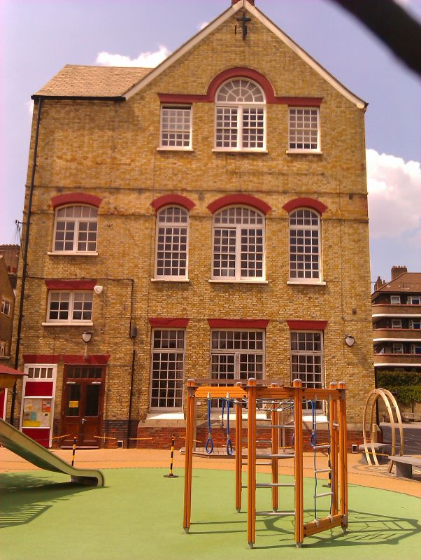
School. 1904-5. By Leonard Stokes. Yellow brick with random blue headers, red brick window dressings; slate roof (replaced) with small fleche. EXTERIOR: south elevation of 3 storeys, 5 main windows, with gable over each outer pair; extension of 2 storeys, 1 window to right. Entrance in west elevation to Flint Street which is of 3 main bays beneath a broad gable with wider bipartite windows to central bay, that on 2nd floor with semicircular radially glazed head. South elevation has gauged, red brick arches to multi-pane sash windows with glazing bars and overlights. Flat arches to ground-floor windows, segmental arches to upper floor windows. Wall blank to left side; extra windows on 1st and ground floors to right. Flat buttresses merging into walls at 2nd-floor level outside and between all 5 main window bays. INTERIOR: not inspected. Faces Church of the English Martyrs, Rodney Road (qv) across former Northampton Place, now a playground.
Listing NGR: TQ3281778587
External links are from the relevant listing authority and, where applicable, Wikidata. Wikidata IDs may be related buildings as well as this specific building. If you want to add or update a link, you will need to do so by editing the Wikidata entry.


Other nearby listed buildings