Approximate Location Map
Large Map »
Latitude: 51.4428 / 51°26'33"N
Longitude: -0.0893 / 0°5'21"W
OS Eastings: 532890
OS Northings: 173260
OS Grid: TQ328732
Mapcode National: GBR HL.S6V
Mapcode Global: VHGR6.DZNW
Plus Code: 9C3XCWV6+37
Entry Name: Stable Building to Belair
Listing Date: 27 September 1972
Grade: II
Source: Historic England
Source ID: 1385542
English Heritage Legacy ID: 470945
ID on this website: 101385542
Location: Dulwich Village, Southwark, London, SE21
County: London
District: Southwark
Electoral Ward/Division: Village
Parish: Non Civil Parish
Built-Up Area: Southwark
Traditional County: Surrey
Lieutenancy Area (Ceremonial County): Greater London
Church of England Parish: Dulwich St Barnabas
Church of England Diocese: Southwark
Tagged with: Stable
SOUTHWARK
TQ3273 GALLERY ROAD
636-1/15/358 (West side)
27/09/72 Stable building to Belair
GV II
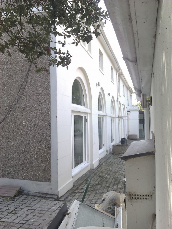
Stables to Belair (qv), now converted to accommodation. Late
C18, altered. North elevation stucco, south elevation brick
and render; low-pitched, hipped slate roof.
2 storeys, 7 bays, end bays slightly projecting. Arcaded
ground-floor with band at spring now has various irregular
window and door openings in recesses. Irregular fenestration
to 1st floor. Contemporary lead pump at west end.
INTERIOR: not inspected.
Listing NGR: TQ3289073260
External links are from the relevant listing authority and, where applicable, Wikidata. Wikidata IDs may be related buildings as well as this specific building. If you want to add or update a link, you will need to do so by editing the Wikidata entry.


Other nearby listed buildings
