Approximate Location Map
Large Map »
Latitude: 51.5007 / 51°30'2"N
Longitude: -0.0791 / 0°4'44"W
OS Eastings: 533428
OS Northings: 179718
OS Grid: TQ334797
Mapcode National: GBR VJ.C7
Mapcode Global: VHGR0.LJ1Y
Plus Code: 9C3XGW2C+79
Entry Name: Warehouse, Sarson's Vinegar Factory
Listing Date: 2 August 1993
Grade: II
Source: Historic England
Source ID: 1385826
English Heritage Legacy ID: 471238
ID on this website: 101385826
Location: Bermondsey, Southwark, London, SE1
County: London
District: Southwark
Electoral Ward/Division: Grange
Parish: Non Civil Parish
Built-Up Area: Southwark
Traditional County: Surrey
Lieutenancy Area (Ceremonial County): Greater London
Church of England Parish: Bermondsey St Mary Magdalen, St Olave, St John and St Luke
Church of England Diocese: Southwark
Tagged with: Warehouse
TQ3379
636-1/5/643
02/08/93
SOUTHWARK
ROPER LANE
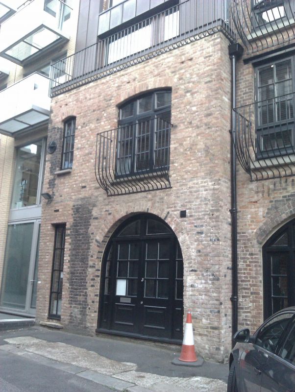
Warehouse, Sarson's Vinegar Factory
GV
II
Warehouse. c1825-30. Stock brick in Flemish bond.
2 storeys and attics. Gable fronted, with top floor covered in
corrugated iron sheeting. 2 small windows to 1st floor.
Round-headed arch blocked in later C20 brickwork with later
door to ground floor.
INTERIOR: not inspected.
Listing NGR: TQ3342879718
External links are from the relevant listing authority and, where applicable, Wikidata. Wikidata IDs may be related buildings as well as this specific building. If you want to add or update a link, you will need to do so by editing the Wikidata entry.


Other nearby listed buildings
