Approximate Location Map
Large Map »
Latitude: 51.4963 / 51°29'46"N
Longitude: 0.0105 / 0°0'37"E
OS Eastings: 539660
OS Northings: 179403
OS Grid: TQ396794
Mapcode National: GBR LV.FB5
Mapcode Global: VHHNJ.4ND8
Plus Code: 9F32F2W6+G6
Entry Name: 70-84, River Way SE10
Listing Date: 28 October 1998
Grade: II
Source: Historic England
Source ID: 1386006
English Heritage Legacy ID: 471427
ID on this website: 101386006
Location: North Greenwich, Greenwich, London, SE10
County: London
District: Greenwich
Electoral Ward/Division: Peninsula
Parish: Non Civil Parish
Traditional County: Kent
Lieutenancy Area (Ceremonial County): Greater London
Church of England Parish: East Greenwich Christ Church, St Andrew and St Michael
Church of England Diocese: Southwark
Tagged with: Building
TQ 3979 RIVER WAY, SE10
(South East side)
786/4/10110
Nos. 70-84
II
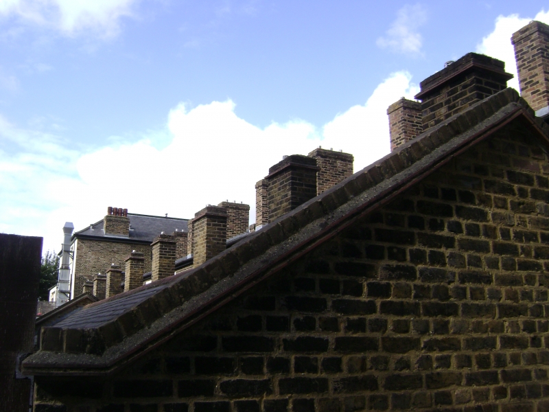
Row of eight cottages. Dated by painted stone tablet on an adjoining property (not included) CEYLON PLACE New East Greenwich 1801'. Yellow stock brick with slate roofs, York stone cills to windows. The cottages of two storeies, one window per floor with gauged arches. Arched door openings. Single storey extension to rear of cottages of c.1900. Interiors of cottages extensively retain original fielded wooden partition walls, wooden stairs, joinery and floorboards. Included as the earliest surviving residential development on the East Greenwich Peninsula, constructed for workers at the adjacent tidal mill and chemical works. A rare survival of late Georgian artisanal housing.
Listing NGR: TQ3966079403
External links are from the relevant listing authority and, where applicable, Wikidata. Wikidata IDs may be related buildings as well as this specific building. If you want to add or update a link, you will need to do so by editing the Wikidata entry.


Other nearby listed buildings
