Latitude: 51.902 / 51°54'7"N
Longitude: -2.0781 / 2°4'41"W
OS Eastings: 394725
OS Northings: 222609
OS Grid: SO947226
Mapcode National: GBR 2M4.PFX
Mapcode Global: VH947.XGS8
Plus Code: 9C3VWW2C+RQ
Entry Name: Numbers 35 and 37 and Attached Area Railings to Number 37
Listing Date: 5 May 1972
Grade: II
Source: Historic England
Source ID: 1387827
English Heritage Legacy ID: 475819
ID on this website: 101387827
Location: Cheltenham, Gloucestershire, GL50
County: Gloucestershire
District: Cheltenham
Electoral Ward/Division: Lansdown
Parish: Non Civil Parish
Built-Up Area: Cheltenham
Traditional County: Gloucestershire
Lieutenancy Area (Ceremonial County): Gloucestershire
Church of England Parish: Cheltenham, St Mary with St Matthew
Church of England Diocese: Gloucester
Tagged with: Building
CHELTENHAM
SO9422NE ST GEORGE'S PLACE 630-1/9/810 (West side) 05/05/72 Nos.35 AND 37 and attached area railings to No.37
GV II
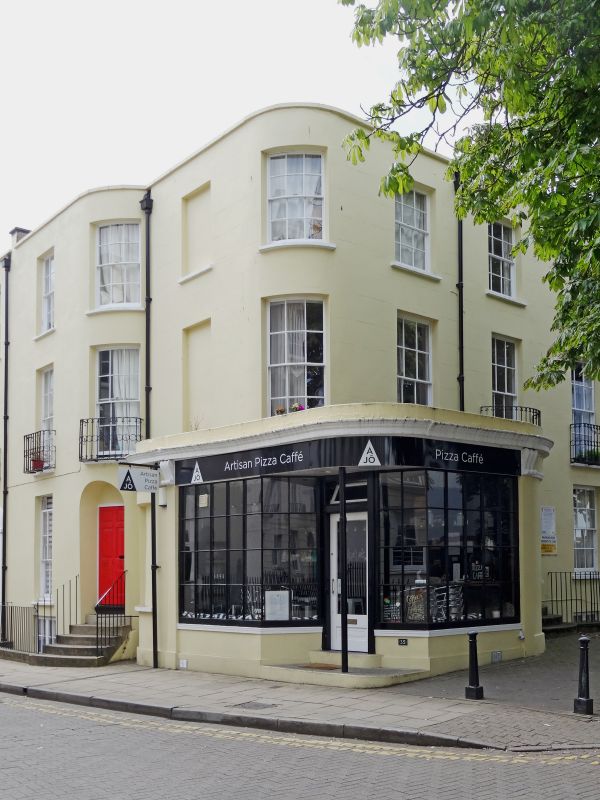
2 terraced houses, now shop at right with flats over, and attached area railings at left. Numbered right to left, described left to right. c1805-20. Stucco over brick with wrought-iron balconies and iron railings. The houses occupy a corner site and are stepped, each step has rounded end. No.35 has projecting shop front to ground floor. EXTERIOR: 3 storeys, part to left on basement, 4 first-floor windows. 6/6 sashes, 3rd bay blind; 2nd and 4th bays are curved on section, all in plain reveals and with sills. Ground floor to No.35 has multi-pane glazed shop front canted into entrance a part-glazed door, surmounted by cornice which projects on console brackets, with blank recesses to left, iron post to centre; entrance below second window: 6-fielded-panel door curved on plan with blind fanlight. Low parapet and copings. Return: shop front to ground floor, otherwise blind openings. INTERIOR: not inspected. SUBSIDIARY FEATURES:individual balconies to first-floor windows have rod and central circle motif, also found on several other houses on St George's Place (qv); area railings with stick balusters to left. HISTORICAL NOTE: building along the west side of St George's Place commenced in 1805; originally known as Stills Lane, it was the only road connecting the High Street with the Royal Well Spa before the Promenade. (Chatwin A: Cheltenham's Ornamental Ironwork: Cheltenham: 1975-1984: 19; Cheltenham Civic Society: Period Shop Fronts Survey: 1989-).
Listing NGR: SO9472222614
External links are from the relevant listing authority and, where applicable, Wikidata. Wikidata IDs may be related buildings as well as this specific building. If you want to add or update a link, you will need to do so by editing the Wikidata entry.


Other nearby listed buildings