Approximate Location Map
Large Map »
Latitude: 55.7383 / 55°44'17"N
Longitude: -4.154 / 4°9'14"W
OS Eastings: 264857
OS Northings: 651533
OS Grid: NS648515
Mapcode National: GBR 3W.CJST
Mapcode Global: WH4R1.5149
Plus Code: 9C7QPRQW+89
Entry Name: Flatt Bridge
Listing Name: Flatt Bridge
Listing Date: 20 February 1979
Category: C
Source: Historic Scotland
Source ID: 330300
Historic Scotland Designation Reference: LB100
Building Class: Cultural
Also known as: Flat Bridge
Old Flatt Bridge
ID on this website: 200330300
Location: East Kilbride
County: South Lanarkshire
Electoral Ward: East Kilbride East
Parish: East Kilbride
Traditional County: Lanarkshire
Tagged with: Bridge
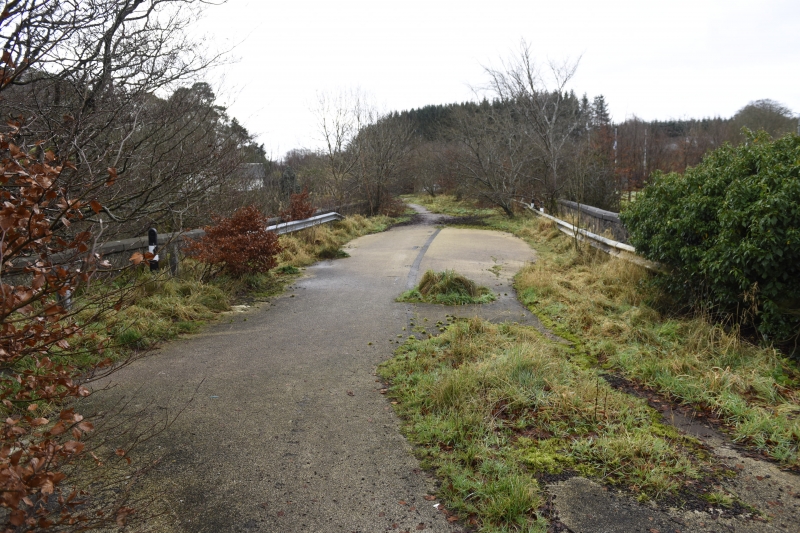
Early 19th century. Spanning Calder Water. Single arch road bridge with small supporting arches; low parapet. Square and coursed stone with bull-faced voussoirs to arch ring 1 side, rough-faced other side. Impost blocks, straight and curved abutments to banks. Ashlar coping to parapet.
The road crossing the bridge is the A726 between Strathaven and East Kilbride.
External links are from the relevant listing authority and, where applicable, Wikidata. Wikidata IDs may be related buildings as well as this specific building. If you want to add or update a link, you will need to do so by editing the Wikidata entry.


Other nearby listed buildings
