Approximate Location Map
Large Map »
Latitude: 57.1489 / 57°8'56"N
Longitude: -2.0984 / 2°5'54"W
OS Eastings: 394147
OS Northings: 806453
OS Grid: NJ941064
Mapcode National: GBR SCF.B7
Mapcode Global: WH9QQ.QKZX
Plus Code: 9C9V4WX2+HM
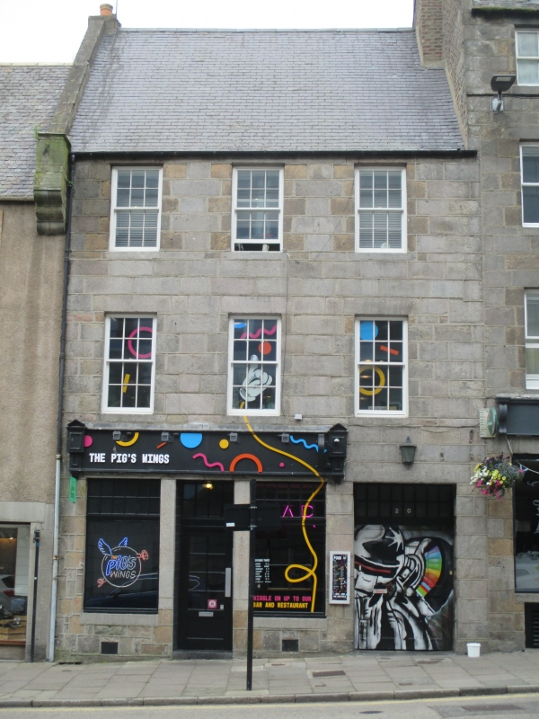
Entry Name: 20, 22 Upperkirkgate, Aberdeen
Listing Name: 20 and 22 Upperkirkgate
Listing Date: 12 January 1967
Category: C
Source: Historic Scotland
Source ID: 355527
Historic Scotland Designation Reference: LB20580
Building Class: Cultural
ID on this website: 200355527
Location: Aberdeen
County: Aberdeen
Town: Aberdeen
Electoral Ward: George St/Harbour
Traditional County: Aberdeenshire
Tagged with: Architectural structure
Early 19th century. 3-storey, 3-bay commercial and residential building with wide rectangular pend and shop to ground floor. Loanhead granite ashlar with strap pointing. Slightly recessed entrance to shop with astragalled rectangular fanlight above; flanked by large fixed-pane windows, astragalled at upper portion. Regular fenestration to upper floors. Entrance to pend now doorway to flatted units above (2006). Harled outshot to rear.
Replacement 12-pane plate glass timber sash and case windows at upper floors; grey slate; broad brick stack abutting attic level gable-end of adjoining building; ashlar skew to left gable; clay cans. Cast-iron rainwater goods.
INTERIOR: Partly seen (2006). Fragments of stone spiral staircase in ground floor rear cupboard.
A good example of late 18th century townhouse with ground floor shop in this part of Aberdeen. Nos 20 and 22 Upperkirkgate is a good example of the tall narrow townhouse with shops to the ground floor which are characteristic of 18th and 19th century Aberdeen. The pend would have provided access to the stairs to upper levels at the rear and side of the building.
Upperkirkgate stands on the site of one of the city's many ancient gates, or 'ports'. However, 'gate' in this instance may have formerly been 'gait' meaning walk or way. Most of what is visible derives from the late eighteenth and nineteenth centuries, but much evidence of earlier structures of previous centuries has been built into the later fabric. The buildings that lined the S side of the street were cleared from the 1930's onwards as part of a programme of slum clearances, and eventually to allow room for the civic buildings of the St Nicholas House development.
External links are from the relevant listing authority and, where applicable, Wikidata. Wikidata IDs may be related buildings as well as this specific building. If you want to add or update a link, you will need to do so by editing the Wikidata entry.


Other nearby listed buildings
