Approximate Location Map
Large Map »
Latitude: 53.2881 / 53°17'17"N
Longitude: -3.2054 / 3°12'19"W
OS Eastings: 319741
OS Northings: 377473
OS Grid: SJ197774
Mapcode National: GBR 6Z1F.V0
Mapcode Global: WH76K.QMT3
Plus Code: 9C5R7QQV+7R
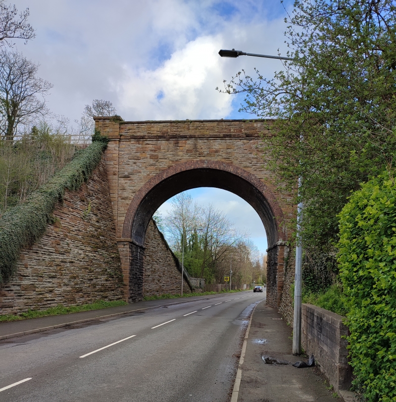
Entry Name: Railway Bridge Spanning the main coast road on a skewed line
Listing Date: 19 August 1991
Last Amended: 19 August 1991
Grade: II
Source: Cadw
Source ID: 500
Building Class: Transport
ID on this website: 300000500
Location: 0.3km from SE of the Junction with Greenfiled Road and Bagillt Road
County: Flintshire
Community: Holywell (Treffynnon)
Community: Holywell
Locality: skewed line
Built-Up Area: Holywell
Traditional County: Flintshire
Tagged with: Railway bridge
Built in 1869 by Holywell Railway Company to carry a railway line S from the wharf up towards Holywell town. This line was unsuccessful and the company was wound up; after that it was used solely for transport to and from the Parys Mine Company Limestone Works - this traffic also ceased by late C19. In 1906 the LNWR reopened it as a goods line and in 1912 followed this with a passenger service; the latter involved extending the line into the centre of Holywell. A new curve was also made to link it with the main Chester to Holyhead Railway. Together this created the steepest (1:27) conventional passenger service in Britain. Closed in 1955.
Tall bull-nosed rubble bridge with semicircular brick arch and brick soffit; stone impost bands. Stringcourse below parapet which have end pilasters.
Ramped and battered revetment walls to both sides with railings at base.
Listed for its special intrest to the railway history of Holywell and the Greenfield Valley.
External links are from the relevant listing authority and, where applicable, Wikidata. Wikidata IDs may be related buildings as well as this specific building. If you want to add or update a link, you will need to do so by editing the Wikidata entry.


Other nearby listed buildings
