Latitude: 51.8194 / 51°49'9"N
Longitude: -3.0292 / 3°1'44"W
OS Eastings: 329158
OS Northings: 213918
OS Grid: SO291139
Mapcode National: GBR F5.WF8P
Mapcode Global: VH796.FJYM
Plus Code: 9C3RRX9C+Q8
Entry Name: Usk Bridge (also known as Abergavenny Bridge)
Listing Date: 7 May 1952
Grade: II*
Source: Cadw
Source ID: 2378
Building Class: Transport
ID on this website: 300002378
Location: Spanning the River Usk and the boundary between Abergavenny and Llanfoist Fawr communities.
County: Monmouthshire
Community: Llanfoist Fawr (Llan-ffwyst Fawr)
Community: Llanfoist Fawr
Locality: Abergavenny
Built-Up Area: Abergavenny
Traditional County: Monmouthshire
Formerly known as Tudor Bridge because it has been recorded as being built by Jasper Tudor, Duke of Bedford and Baron Abergavenny in the reign of Henry VI (1422-61). Although this is the medieval river crossing the present bridge is stylistically later, possibly C17, and seems to be a complete rebuild of the original sixteen arches, while it also shows substantial evidence of subsequent alterations. It was possibly widened on the upstream side in the early C19 in association with the tramroad which ran parallel to it but at a higher level. The suggestion that it actually incorporated the tramroad seems unfounded because of the difference in level and because the Gastineau engraving shows William Crossley's bridge as quite separate and taller. Usk bridge was widened and altered again in c1868 at the time the tramway bridge was demolished and replaced by the iron bridge of the Abergavenny and Merthyr Railway which was itself demolished in 1968 leaving the still surviving abutments. More recently the parapets have been rebuilt.
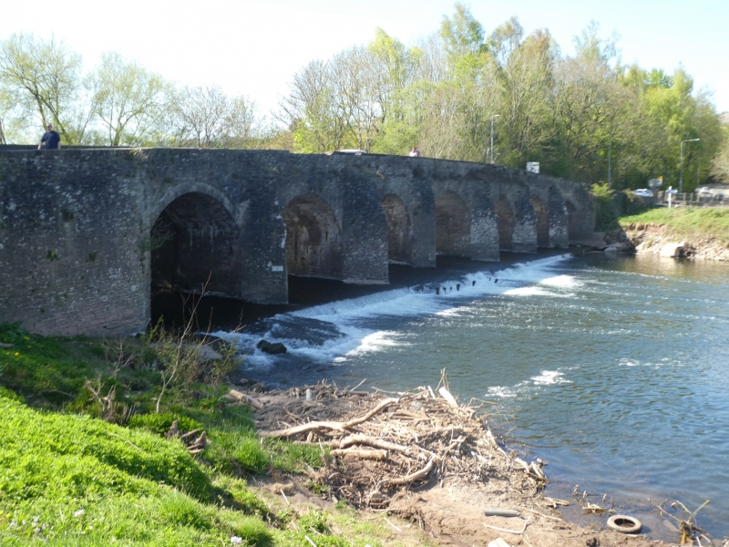
Seven arch cut sandstone road bridge with mostly segmental, voussoired arches. On the downstream side the central and northern arches are more acutely pointed and the southernmost arch has been rebuilt with arch ring and keystone. Pointed cutwaters and ramped deck. There are two low flood arches at the Abergavenny end with a stepped abutment between; also an embanked causeway at both ends. The bridge has been widened on the upstream side and has more regularly shaped segmental arches with the cutwaters between stepped up beneath the rebuilt parapet. Also on this upstream side are corbelled brackets which once carried a railing of some kind.
The low parapets have a flat coping. On the downstream side it continues on Llanfoist bank up to the entrance to The Bridge End Inn and on the Abergavenny bank up to the gate to the riverside footpath. Upstream the parapet does not extend beyond the length of the bridge.
Included at a higher grade as a fine historic bridge of handsome appearance.
Scheduled Monument (as Abergavenny Bridge) MM010.


Other nearby listed buildings