Approximate Location Map
Large Map »
Latitude: 51.9976 / 51°59'51"N
Longitude: -4.9711 / 4°58'15"W
OS Eastings: 196137
OS Northings: 237413
OS Grid: SM961374
Mapcode National: GBR CK.JCM9
Mapcode Global: VH1QM.S1CY
Plus Code: 9C3QX2XH+3H
Entry Name: The Quay, including slipway, bollard and flights of steps.
Listing Date: 24 November 1978
Last Amended: 7 January 2002
Grade: II
Source: Cadw
Source ID: 12352
Building Class: Maritime
ID on this website: 300012352
Location: Quay wall on the E side of the harbour, extending along Quay Street running north and north-west from opposite No 3 Quay Street.
County: Pembrokeshire
Town: Fishguard
Community: Fishguard and Goodwick (Abergwaun ac Wdig)
Community: Fishguard and Goodwick
Locality: Lower Town
Traditional County: Pembrokeshire
Tagged with: Wharf
There was probably moorage at the mouth of the Gwaun from the C16, Fishguard being said to have grown then with the decline of Newport. The harbour is shown in Lewis Morris’s Plans of Harbours of 1748. According to Richard Fenton, in the second half of C18, his uncle, Lieutenant Samuel Fenton, built the long landing stage up to near the bridge over the Gwaun river, fitting it with mooring posts, all of which he kept in repair at his own expense. The top of the quay may then have been rough, consisting of huge boulders placed together as closely as possible with posts fixed between the stones, and it may have extended only S as far as the first slipway. The present structure seems to date from the earlier C19 with the NW breakwater a mid to later C19 addition, not shown on the 1844 tithe map, but on a photo of c1870.
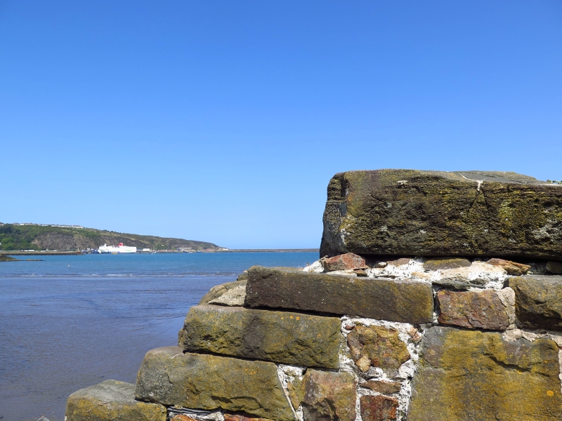
Stone rubble retaining wall to quay, with rough stone coping. Slipway with rough stone paving outside No 37, flight of stone steps parallel to quay outside No 19; steep flight of steps in angle between main quay and NW breakwater; narrow inset steps also by Nos 8, 19 and 33. Cast-iron bollard to north of slipway outside No 37. Quay wall is higher and curving after the slipway, and then NW end returns as breakwater at right angles. Breakwater has rubble wall with stone slab coping on N side, and face to the water slopes with top surface of stone rubble.
Included as the historic quayside of Fishguard, in use probably from the C16. Of group value with the listed houses on the quay.
External links are from the relevant listing authority and, where applicable, Wikidata. Wikidata IDs may be related buildings as well as this specific building. If you want to add or update a link, you will need to do so by editing the Wikidata entry.


Other nearby listed buildings
