Approximate Location Map
Large Map »
Latitude: 51.8757 / 51°52'32"N
Longitude: -5.1873 / 5°11'14"W
OS Eastings: 180698
OS Northings: 224485
OS Grid: SM806244
Mapcode National: GBR C8.S5YN
Mapcode Global: VH1R3.13JX
Plus Code: 9C3PVRG7+73
Entry Name: Solva Bridge
Listing Date: 4 February 1991
Last Amended: 4 February 1991
Grade: II
Source: Cadw
Source ID: 12443
Building Class: Transport
ID on this website: 300012443
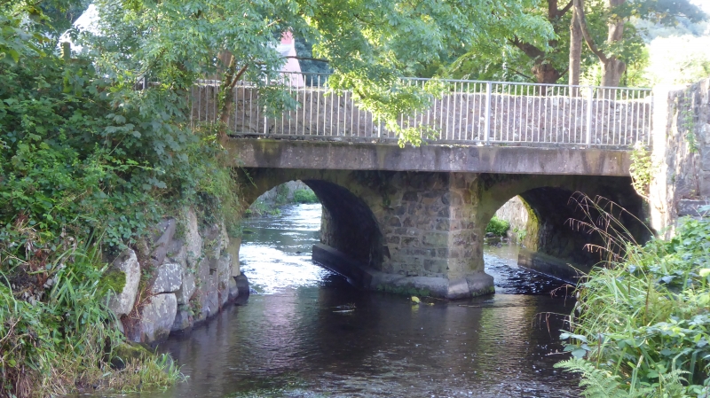
Location: Situated at northern end of Main Street (A487) where it crosses the River Solva.
County: Pembrokeshire
Community: Solva (Solfach)
Community: Solva
Locality: Solfach Isaf/Lower Solva
Traditional County: Pembrokeshire
Tagged with: Bridge Road bridge
C18 or early C19 rubble stone road bridge over River Solva. Two low, round arches with rubble voussoirs and keystones, slightly projected centre plain pier and abutments each side. Plain coped parapet. N side has pointed cutwater and C20 concrete footbridge adjoining.
External links are from the relevant listing authority and, where applicable, Wikidata. Wikidata IDs may be related buildings as well as this specific building. If you want to add or update a link, you will need to do so by editing the Wikidata entry.


Other nearby listed buildings
