Approximate Location Map
Large Map »
Latitude: 51.4079 / 51°24'28"N
Longitude: -3.4875 / 3°29'15"W
OS Eastings: 296635
OS Northings: 168698
OS Grid: SS966686
Mapcode National: GBR HJ.QFH5
Mapcode Global: VH5HZ.HWN3
Plus Code: 9C3RCG56+4X
Entry Name: Churchyard Walls & Gates to Church of St Illtud
Listing Date: 10 September 1982
Last Amended: 16 December 2004
Grade: II
Source: Cadw
Source ID: 13257
Building Class: Religious, Ritual and Funerary
ID on this website: 300013257
Location: Completely surrounding the churchyard of the Church of St Illtud.
County: Vale of Glamorgan
Town: Cowbridge / Y Bont-Faen
Community: Llantwit Major (Llanilltud Fawr)
Community: Llantwit Major
Built-Up Area: Llantwit Major
Traditional County: Glamorgan
Tagged with: Churchyard wall Church gate
Mostly C19 with C20 repairs, although some earlier work may be incorporated as part at least of the Churchyard must have been walled previously.
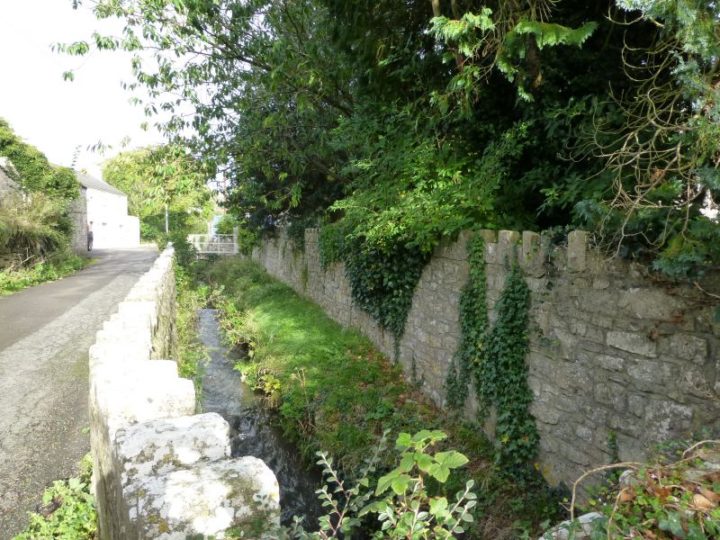
Limestone rubble walls about 1.5m in height, mostly with an up-and-down coping. At east entrance, C19 gate piers and iron gates set above flight of ten rounded steps with solid stone balustrades; the iron gates with circular uprights with spear-headed finials above top rail. Smaller west churchyard gate of C19 with circular uprights with finials rising above top and middle rails; flanking stone gate piers with pyramidal coping. At the south-east entrance, a pair of stone gate piers with pyramidal coping flanking a pair of tall C19 iron gates with circular uprights with spear headed finials rising above the top rail. To south of west churchyard entrance, the churchyard walls divide into two at a point roughly parallel to the ruined Chantry Priest’s house, the low south-west wall bounding the stream along the road; where the stream crosses under the road, immediately to north-east of steps to Hillhead, this wall then returns to the Chantry House. The other wall returns to the north-west end of the former Chantry Priest’s House.
Included for group value with the Church of St Illtud and other nearby historic buildings.
External links are from the relevant listing authority and, where applicable, Wikidata. Wikidata IDs may be related buildings as well as this specific building. If you want to add or update a link, you will need to do so by editing the Wikidata entry.


Other nearby listed buildings
