History in Structure

Hengoed Viaduct (partly in Maesycwmmer Community)

A Grade II* Listed Building in Ystrad Mynach, Caerphilly

More Photos »
Approximate Location Map
Large Map »

Coordinates

Latitude: 51.6468 / 51°38'48"N

Longitude: -3.2238 / 3°13'25"W

OS Eastings: 315422

OS Northings: 194936

OS Grid: ST154949

Mapcode National: GBR HW.7FTM

Mapcode Global: VH6DF.2VKX

Plus Code: 9C3RJQWG+PF

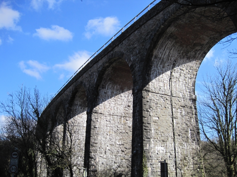
Entry Name: Hengoed Viaduct (partly in Maesycwmmer Community)

Listing Date: 31 July 1980

Last Amended: 18 July 2001

Grade: II*

Source: Cadw

Source ID: 13566

Building Class: Transport

ID on this website: 300013566

Location: A prominent landscape feature spanning the Rhymney Valley between Maesycwmmer and Hengoed.

County: Caerphilly

Community: Gelligaer

Community: Gelligaer

Locality: Hengoed

Built-Up Area: Ystrad Mynach

Traditional County: Glamorgan

Tagged with: Footbridge

Find accommodation in
Mynyddislwyn

Exterior

See Record Number 22325 in Maesycwmmer Community for full description of this viaduct.

External Links

External links are from the relevant listing authority and, where applicable, Wikidata. Wikidata IDs may be related buildings as well as this specific building. If you want to add or update a link, you will need to do so by editing the Wikidata entry.

Recommended Books

Other nearby listed buildings

  • II* The Woollen Mill
    Backing onto the River Rhymney beneath the Hengoed railway viaduct. Accessed from the driveway to Maesycwmmer House
  • II Footbridge at Hengoed Station
    At Hengoed Station.
  • II* Hengoed Viaduct
    A prominent landscape feature spanning the Rhymney valley between Maesycwmmer and Hengoed.
  • II* Tabor United Reformed Church
    On prominent site fronting Tabor Road with North Avenue to the rear.
  • II Capel Hengoed (also known as Hengoed Baptist Chapel)
    Situated above Hengoed, close to Cefn Hengoed; set back from hill road that runs north from Ystrad Mynach. Burial ground to front with good C19 monuments.
  • II Church of Holy Trinity
    A472 skirts the W side of Ystrad centre; church is set back from the road on a knoll within a very hilly walled churchyard which falls away steeply to W and S, main entry at SE through lychgate.
  • II War Memorial
    Just off Caerphilly Road in a square to the north of Ysbyty Ystrad Fawr, approx. 50m W of the Old Fire Station (rec no 13569).
  • II Old Fire Station
    Originally situated off Park Road but now resited in grounds of Caerphilly County Borough Council offices at Ystrad Fawr, to W of main house.

BritishListedBuildings.co.uk is an independent online resource and is not associated with any government department. All government data published here is used under licence. Please do not contact BritishListedBuildings.co.uk for any queries related to any individual listed building, planning permission related to listed buildings or the listing process itself.

British Listed Buildings is a Good Stuff website.