Approximate Location Map
Large Map »
Latitude: 53.1059 / 53°6'21"N
Longitude: -4.0782 / 4°4'41"W
OS Eastings: 260976
OS Northings: 358542
OS Grid: SH609585
Mapcode National: GBR 5R.8CV2
Mapcode Global: WH54V.B688
Plus Code: 9C5Q4W4C+9P
Entry Name: Bryn Glas
Listing Date: 28 May 1999
Last Amended: 28 May 1999
Grade: II
Source: Cadw
Source ID: 21836
Building Class: Domestic
ID on this website: 300021836
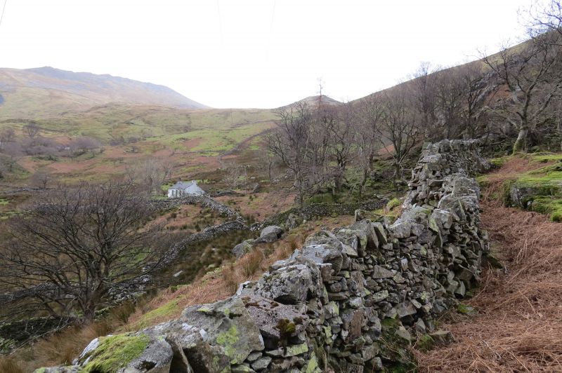
Location: Situated in an isolated position without vehicular access on a rock outcrop on hillside in small rubblestone-walled enclosure above the A 4086 at Nant Peris.
County: Gwynedd
Town: Caernarfon
Community: Llanberis
Community: Llanberis
Locality: Nant Peris
Traditional County: Caernarfonshire
Tagged with: Cottage
Mid-C19 quarry worker's cottage, sustained by the dual agricultural/ industrial economy; not shown on the 1838 Tithe Map.
Single-storey quarry worker's cottage. 2-room plan with integral end stacks and entrance slightly offset to right; full-width catslide outshut to rear. Limewashed rubblestone; slate roof with slate coping to left gable end. 4-pane sashes with slate cills to either side of central boarded door with narrow overlight. Late C20 addition attached to rear left corner.
The garden is separated from the remainder of the rubble-walled enclosure by a fence of thin vertical slate slabs set into the ground, linked by horizontal iron wire with a timber gate roughly to centre.
Interior not accessible at time of survey.
Listed as an almost unaltered mid-C19 cottage, still exhibiting all the features of the local vernacular tradition. Single-storey vernacular cottages of this type form a particularly significant element in the dispersed settlement pattern associated with the dual economy, but well-preserved examples are becoming rare.
External links are from the relevant listing authority and, where applicable, Wikidata. Wikidata IDs may be related buildings as well as this specific building. If you want to add or update a link, you will need to do so by editing the Wikidata entry.


Other nearby listed buildings
