History in Structure

Arch over Culvert

A Grade II Listed Building in Margam, Neath Port Talbot

More Photos »
Approximate Location Map
Large Map »

Coordinates

Latitude: 51.563 / 51°33'46"N

Longitude: -3.7288 / 3°43'43"W

OS Eastings: 280260

OS Northings: 186320

OS Grid: SS802863

Mapcode National: GBR H6.DLT3

Mapcode Global: VH5H2.BZ25

Plus Code: 9C3RH77C+6F

Entry Name: Arch over Culvert

Listing Date: 25 April 2000

Last Amended: 25 April 2000

Grade: II

Source: Cadw

Source ID: 23276

Building Class: Gardens, Parks and Urban Spaces

ID on this website: 300023276

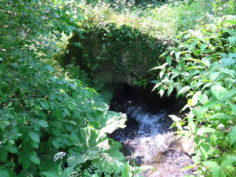
Location: The culvert receives water from the cascade to the NE, beyond which is the lake. The ground slopes down sharply to the S but becomes flatter where the water passes underground.

County: Neath Port Talbot

Town: Port Talbot

Community: Margam

Community: Margam

Locality: Margam Park

Traditional County: Glamorgan

Tagged with: Architectural structure

Find accommodation in
Margam

History

The lake to the N was developed out of a fishpond in 1841 by C R M Talbot. It is likely that the culvert and the wall containing the archway are contemporary.

Exterior

Open stone-lined culvert with flat stone coping. Water enters the N end under a round arch of narrow voussoirs. This arch is part of the N boundary wall of the castle gardens, and the top of the wall rises over the arch in the same semi-circular profile. At the S end of the culvert, the water passes underground under a high flat-headed opening. Adjacent to it on the E side, a few stone steps lead down from the S, with a pump located within a small square enclosure to the E.

Reasons for Listing

Listed as a garden feature in Margam Park retaining architectural character. Group value with other structures in Margam Park.

External Links

External links are from the relevant listing authority and, where applicable, Wikidata. Wikidata IDs may be related buildings as well as this specific building. If you want to add or update a link, you will need to do so by editing the Wikidata entry.

Recommended Books

Other nearby listed buildings

  • II Broadwalk Steps
    Located near the W end of the broadwalk, E of the orangery and chapter house. The broadwalk rises up to the E with Margam Castle as the focal point.
  • I Ruins of Chapter House and Vestibule of St Mary's Abbey
    Located in a central position in the gardens at Margam Park, to the NE of the orangery.
  • I Ruined Undercroft at St Mary's Abbey
    Located to the S of the Chapter House and E of Margam Orangery.
  • I St Mary's Abbey Church
    Located at the end of a short lane which runs NE off the A48. The Stones Museum is within the churchyard. The S doorway faces into Margam Park.
  • II Stones Museum
    Within the churchyard and adjoining the W boundary wall near the NW corner.
  • II Churchyard Walls and Gate Piers to St Mary's Abbey Church
    Enclosure walls to a large, roughly rectangular churchyard to the N of the abbey church. It projects round to the W and incorporates the entrance gates.
  • II War Memorial
    Located immediately outside and to the R of the entrance gates to St Mary's Abbey Church and churchyard.
  • I Margam Orangery
    The centre-piece in the gardens at Margam Park. The abbey remains are immediately to the NE, with the broadwalk leading up to Margam Castle further E.

BritishListedBuildings.co.uk is an independent online resource and is not associated with any government department. All government data published here is used under licence. Please do not contact BritishListedBuildings.co.uk for any queries related to any individual listed building, planning permission related to listed buildings or the listing process itself.

British Listed Buildings is a Good Stuff website.