Approximate Location Map
Large Map »
Latitude: 51.5588 / 51°33'31"N
Longitude: -3.7337 / 3°44'1"W
OS Eastings: 279911
OS Northings: 185862
OS Grid: SS799858
Mapcode National: GBR H5.F5KM
Mapcode Global: VH5H8.72HV
Plus Code: 9C3RH758+GG
Entry Name: Milepost near Margam Park Entrance
Listing Date: 25 April 2000
Last Amended: 25 April 2000
Grade: II
Source: Cadw
Source ID: 23285
Building Class: Transport
ID on this website: 300023285
Location: Prominently sited in front of the boundary wall of Margam Park.
County: Neath Port Talbot
Town: Port Talbot
Community: Margam
Community: Margam
Traditional County: Glamorgan
Tagged with: Milestone
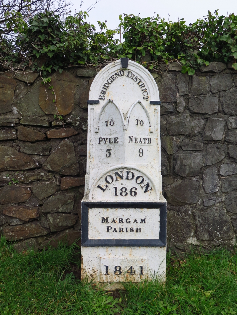
One of a group of mileposts in Gothic style, associated with the turnpiking of the A48. This milepost is not in its original position and has been moved S from the site of the M4.
Ornate cast iron milepost, painted white with black lettering and detail. Square base supporting a rear upright with pointed arched head with mouldings, imposts and keystone. In front, the base supports a low domed section with round-headed front face, above which are 2 tall faces with pointed arched heads each set at an angle of 45 degrees. The arches have raised mouldings.
Underneath the rear arch, the milepost reads 'Bridgend District'. The angled faces point in opposite directions, one reading 'To Pyle 3' and the other 'To Neath 9'. Underneath the round arch is the lettering 'London 186'. The square base has a raised border within which 'Margam Parish' is written in relief. A raised tablet at the bottom reads '1841'.
Listed for its historic interest as a characteristic feature of turnpike roads, and in an unusually ornate Gothic style. Group value with other mileposts on this section of the A48.
External links are from the relevant listing authority and, where applicable, Wikidata. Wikidata IDs may be related buildings as well as this specific building. If you want to add or update a link, you will need to do so by editing the Wikidata entry.


Other nearby listed buildings
