Approximate Location Map
Large Map »
Latitude: 51.6675 / 51°40'2"N
Longitude: -2.8816 / 2°52'53"W
OS Eastings: 339127
OS Northings: 196892
OS Grid: ST391968
Mapcode National: GBR JB.63W6
Mapcode Global: VH7B2.0CH1
Plus Code: 9C3VM489+X9
Entry Name: Churchyard Cross
Listing Date: 22 June 2000
Last Amended: 22 June 2000
Grade: II
Source: Cadw
Source ID: 23491
Building Class: Religious, Ritual and Funerary
ID on this website: 300023491
Location: Situated in churchyard S of parish church.
County: Monmouthshire
Town: Usk
Community: Llantrisant Fawr
Community: Llantrisant Fawr
Locality: Llantrissent/Llantrisant
Traditional County: Monmouthshire
Tagged with: Christian cross
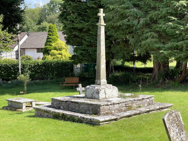
Steps and base of a medieval churchyard cross, with later C20 stone cross.
Churchyard cross on broad square two-step medieval platform, the lower step with chamfered nosing, the upper stone-flagged. Medieval square cross-base, broached to octagonal, with humped broaches and incised bead-mould outlining chamfered top. C20 tapering square tooled stone shaft with red sandstone Latin cross, possibly reused.
Included as a churchyard cross with substantial medieval base, of group value with the parish church.
External links are from the relevant listing authority and, where applicable, Wikidata. Wikidata IDs may be related buildings as well as this specific building. If you want to add or update a link, you will need to do so by editing the Wikidata entry.


Other nearby listed buildings
