Approximate Location Map
Large Map »
Latitude: 51.6689 / 51°40'8"N
Longitude: -2.8815 / 2°52'53"W
OS Eastings: 339136
OS Northings: 197049
OS Grid: ST391970
Mapcode National: GBR JB.63WS
Mapcode Global: VH7B2.09JY
Plus Code: 9C3VM499+HC
Entry Name: Ty Mawr
Listing Date: 22 June 2000
Last Amended: 22 June 2000
Grade: II
Source: Cadw
Source ID: 23494
Building Class: Domestic
ID on this website: 300023494
Location: Situated on W side of road at entry to Llantrisant village
County: Monmouthshire
Town: Usk
Community: Llantrisant Fawr
Community: Llantrisant Fawr
Locality: Llantrissent/Llantrisant
Traditional County: Monmouthshire
Tagged with: Farmhouse
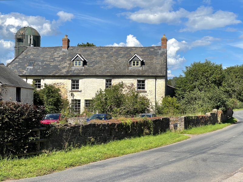
Farmhouse, probably of C17 origin, extended in C18. The left end with hipped roof may be the older part. Marked on 1840 Tithe Map as owned by Ashton Mosley and Every Nicholas, occupied by William Bowler, with 184 acres (74.47 hectares).
Farmhouse, yellow-washed rubble stone with close-eaved slate roof, hipped to left end. Brick stacks on ridge and at right end. Two storeys, 4-window range. First floor has 3 narrow 6-pane sashes to right of ridge stack, one to left, over porch. Timber lintels. Ground floor left has timber cross window and half-glazed door in gabled porch of painted rubble stone. Ground floor to right has pair of large C19 18-pane sashes with brick pier between, door in broad painted rubble stone porch and 6-pane window. Porch is plastered within, with stone seats and painted grained door, 2 big panels and 2 glazed panels. Heavy ovolo-moulded frame may be C19. Windows have stone sills. Colourwashed windowless right end wall. Left end has casement pair to first floor and gabled eaves dormer. Rear left is obscured by added C20 farm buildings built against a single-storey outbuilding at right angles to house. This is open to front and has rubble stone rear and slate roof. To right of this, rear wall of house has one first floor casement window.
Not fully accessible at time of survey. Kitchen at left has 2 heavy beams, large fireplace, baking-oven to left, and door to right with stone chamfered surround. Detail in main part of house appears to be C19.
Included as a substantial traditional farmhouse of C17 origins, altered in C18, with surviving detail of both periods.
External links are from the relevant listing authority and, where applicable, Wikidata. Wikidata IDs may be related buildings as well as this specific building. If you want to add or update a link, you will need to do so by editing the Wikidata entry.


Other nearby listed buildings
