Approximate Location Map
Large Map »
Latitude: 51.5065 / 51°30'23"N
Longitude: -3.175 / 3°10'30"W
OS Eastings: 318543
OS Northings: 179278
OS Grid: ST185792
Mapcode National: GBR KK9.1X
Mapcode Global: VH6F6.XDBF
Plus Code: 9C3RGR4F+JX
Entry Name: Lake Dam including Spillways
Listing Date: 30 November 2001
Last Amended: 30 November 2001
Grade: II
Source: Cadw
Source ID: 25944
Building Class: Gardens, Parks and Urban Spaces
ID on this website: 300025944
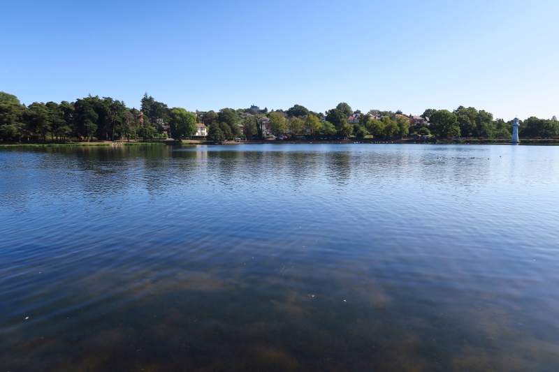
Location: The dam forms the S boundary to Roath Park Lake and is surmounted by a Promenade which links Lake Road West and Lake Road East.
County: Cardiff
Town: Cardiff
Community: Cyncoed
Community: Cyncoed
Locality: Roath Park
Built-Up Area: Cardiff
Traditional County: Glamorgan
Tagged with: Architectural structure
Roath Park, one of the largest Victorian parks in S Wales, was made along the valley floor of the Roath Brook on land donated by the Marquess of Bute in 1887. It was opened in 1894 and laid out by William Harpur, borough engineer, and planted by the head gardener, William Wallace Pettigrew. An elongated lake occupies a large proportion of the park. It is dammed at the S end, beyond which are an arboretum and botanic gardens including a glasshouse. To the S of Eastern Avenue (in Plasnewydd community) are pleasure gardens and a recreation ground.
The lake, originally known as the reservoir, was created between 1889 and 1893 and the dam is an original part of that construction.
Wide straight stone-revetted dam orientated E-W. The wall on the N side, facing the lake, is concave and battered, whilst the S side is embanked above the level of the formal gardens and laid with grass. A Promenade runs along the top of the dam, bound by late C20 iron railings and partly laid with paviers. Under the W end of the dam is a spillway to allow water to flow from the lake into a channel and hence into the Roath Brook to the S. This is in the form of a cascade which runs under a bridge beneath the dam and then curves round towards the SE. The bridge has simple cast iron girders and the abutments and sides of the spillway are of snecked rock-faced stone. The W end of the dam is continuous with the spillway, the E ends curving outwards.
Listed as an extremely rare example of a constructional dam in the context of a recreational park, and one of the few original structures surviving at Roath Park. Group value with other historic structures in the park.
External links are from the relevant listing authority and, where applicable, Wikidata. Wikidata IDs may be related buildings as well as this specific building. If you want to add or update a link, you will need to do so by editing the Wikidata entry.


Other nearby listed buildings
