Approximate Location Map
Large Map »
Latitude: 51.5119 / 51°30'42"N
Longitude: -3.2379 / 3°14'16"W
OS Eastings: 314193
OS Northings: 179950
OS Grid: ST141799
Mapcode National: GBR K27.ZZ
Mapcode Global: VH6F5.T8M9
Plus Code: 9C3RGQ66+QV
Entry Name: Former Towpath Bridge to Glamorganshire Canal
Listing Date: 31 May 2002
Last Amended: 31 May 2002
Grade: II
Source: Cadw
Source ID: 26716
Building Class: Transport
ID on this website: 300026716
Location: Beside the footpath to the Afon Taff railway bridge and about 50m north west of Oak Cottage.
County: Cardiff
Town: Cardiff
Community: Whitchurch (Yr Eglwys Newydd)
Community: Whitchurch
Built-Up Area: Cardiff
Traditional County: Glamorgan
Tagged with: Bridge
The Glamorganshire Canal was built by a consortium of Merthr Tydfil businessmen, led by the ironmaster, Richard Crawshay, to ease the carriage of their products down to Cardiff and the sea. It opened in 1794 and was immediately very successful. It rapidly became very overcrowded and eventually was given competition by the Taff Vale Railway which ran alongside from 1841. Despite this the canal continued to flourish for most of the C19 but traffic then declined rapidly after the railways opened new coal docks at Roath and Barry in c1890. The canal finally closed in 1942 and is now mostly under the main Cardiff-Merthyr road. This bridge ciould well be contemporary with the opening of the canal, but it should be noted that the similar bridge (qv) about 500m north is dated 1851.
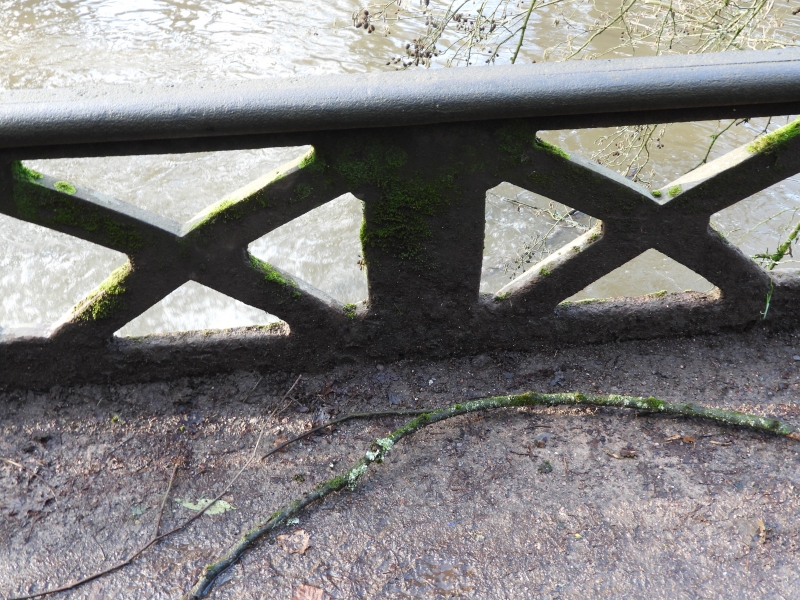
Cast-iron bridge, probably with stone abutments, which once carried the towpath of the Monmouthshire Canal over an overflow from the canal into the Melingriffith Tinplate Works tailrace. Cast iron road with trellis iron parapets; these have flat copings on both sides. This bridge was immediately to the north of the Melingriffith Lock and appears to be in situ. The Canal ran along the line of Ty-Mawr Road. Compare with the similar bridge about 500m north where a section of the canal survives with water.
Included as an attractive structure of special technological interest and associated with an important canal.
External links are from the relevant listing authority and, where applicable, Wikidata. Wikidata IDs may be related buildings as well as this specific building. If you want to add or update a link, you will need to do so by editing the Wikidata entry.


Other nearby listed buildings
