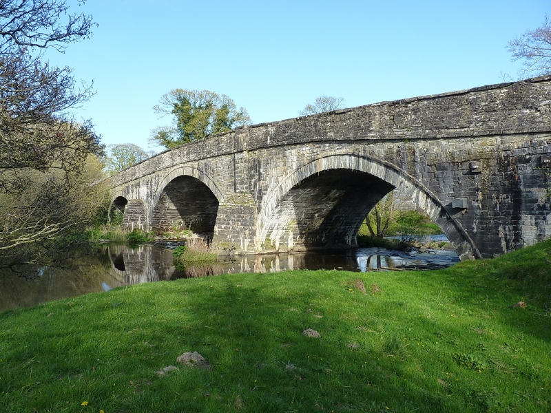
Pont Melin Rug
A Grade II* Listed Building in Cynwyd, Denbighshire
Coordinates
Latitude: 52.9807 / 52°58'50"N
Longitude: -3.4157 / 3°24'56"W
OS Eastings: 305046
OS Northings: 343529
OS Grid: SJ050435
Mapcode National: GBR 6M.JBSG
Mapcode Global: WH780.HBPS
Plus Code: 9C4RXHJM+7P
Entry Name: Pont Melin Rug
Listing Date: 20 October 1966
Grade: II*
Source: Cadw
Source ID: 82411
ID on this website: 300082411
Location: Carries the A5 over the River Alwen approx. 2 km W of Corwen.
County: Denbighshire
Community: Cynwyd
Community: Cynwyd
Locality: Plas Ucha
Traditional County: Merionethshire
History
Probably built in the early C18 and similar in style to the local bridges over the River Dee at Corwen, Carrog and Cynwyd.
Exterior
See Record Number 673 in the Corwen community for full description.
Reasons for Listing
Listed grade II* as a very fine example of a masonry bridge, one of an important series of river bridges in the area from the late C17-early C18.
Recommended Books
Other nearby listed buildings
-
II*
Pon Melin Rug Bridge
Carries the A5 road over the River Alwen 2km approx. W of Corwen.
-
II
Entrance Gates at Rug
At the main entrance to the estate from the A5.
-
II
Plas Isaf
Located down a short track off the W side of a lane which runs from Cynwyd to Melin Rug and approximately 0.5km from Pont Melin Rug.
-
II
Ice House in the grounds at Rug
Built into the motte towards the SW of the lake.
-
II
Penlan Fawr
To the east of and below the lane that leaves the A494 at Druid, 1km approx. from the junction with the main A5 road.
-
II*
Rug
In parkland on the N side of the A5, 3km approx. W of Corwen.
-
II
Gate in Garden at Rug
Aligned with the main entrance of the house, at the boundary of garden and park.
-
I
Plas Ucha
Located off the W side of a lane which runs N from Cynwyd to Melin Rug. The front faces S, the ground sloping downhill to the E.