Latitude: 52.8841 / 52°53'2"N
Longitude: -3.909 / 3°54'32"W
OS Eastings: 271641
OS Northings: 333560
OS Grid: SH716335
Mapcode National: GBR 5Z.QBYC
Mapcode Global: WH55W.XRQT
Plus Code: 9C4RV3MR+M9
Entry Name: Milestone by Bryn Llefrith
Listing Date: 27 February 2004
Last Amended: 27 February 2004
Grade: II
Source: Cadw
Source ID: 82539
Building Class: Transport
ID on this website: 300082539
Location: Set along the E side of a country road which leads SSE off the A470 to S of Trawsfynydd to Penystryd and on to Abergeirw and Dolgellau. The milestone is set in the wall to S of the entrance to Bryn L
County: Gwynedd
Community: Trawsfynydd
Community: Trawsfynydd
Locality: Nant Bryn Llefrith
Traditional County: Merionethshire
Tagged with: Milestone
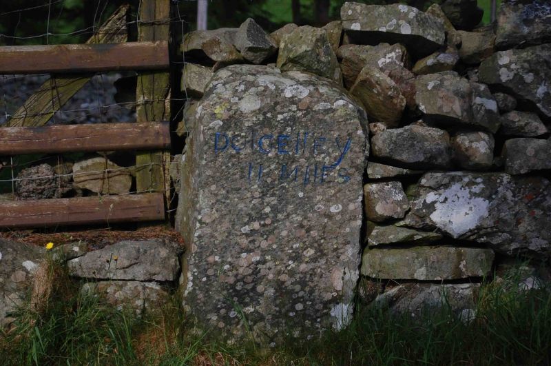
Probably C18 milestone, similar in style to several dated mid C18 stones along the road between Harlech and Barmouth, and probably pre-dating the Turnpikes in the county. Merioneth was the last of the Welsh counties to have turnpike roads and it was at a county meeting in Dolgellau in 1775 that it was resolved to convert the principal tracks of the county into turnpikes, in partnership with Caernarfonshire. By the end of the C18 most of the existing roads had been brought under the Trust under the Merioneth Turnpike Act of 1777, the main road between Maentwrog and Dolgellau (the present A470) was in place by the Tithe Map of the parish, 1849, and had probably become the principal route through the county by that time.
Large boulder slab milestone, now set into a drystone wall, which bears the incised lettering: DOLGELLEY / 11 MILES.
Listed as a good C18 milestone, of interest as it represents the importance of the route as the principal road from Dolgellau to Trawsfynydd before the A470 was built.
External links are from the relevant listing authority and, where applicable, Wikidata. Wikidata IDs may be related buildings as well as this specific building. If you want to add or update a link, you will need to do so by editing the Wikidata entry.


Other nearby listed buildings