Approximate Location Map
Large Map »
Latitude: 51.7024 / 51°42'8"N
Longitude: -2.9006 / 2°54'2"W
OS Eastings: 337860
OS Northings: 200795
OS Grid: SO378007
Mapcode National: GBR J9.3YZN
Mapcode Global: VH79V.NGYR
Plus Code: 9C3VP32X+XQ
Entry Name: Section of churchyard wall linking gatehouse and priory church
Listing Date: 30 April 2004
Last Amended: 30 April 2004
Grade: II
Source: Cadw
Source ID: 82783
Building Class: Religious, Ritual and Funerary
ID on this website: 300082783
Location: At SW corner of churchyard.
County: Monmouthshire
Town: Usk
Community: Usk (Brynbuga)
Community: Usk
Built-Up Area: Usk
Traditional County: Monmouthshire
Tagged with: Wall
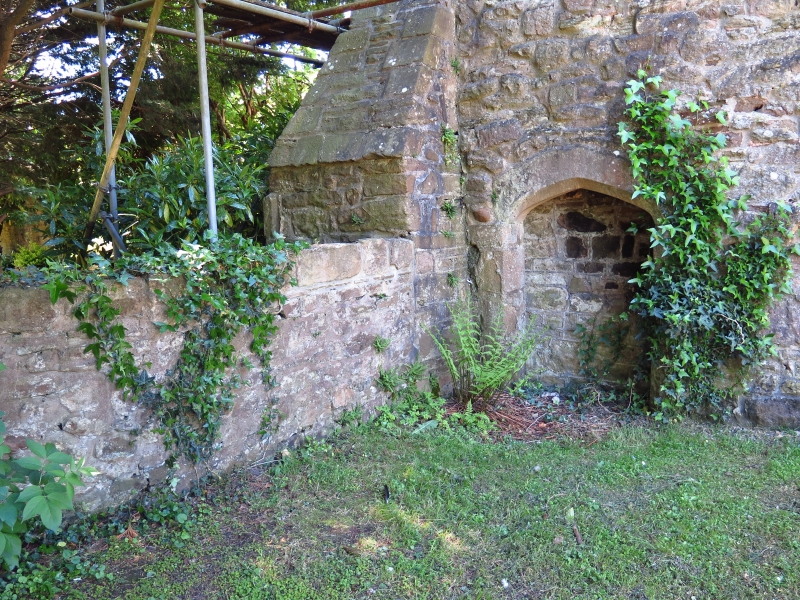
Part of the medieval enclosed churchyard.
Length of rubble wall joining the Priory Gatehouse with the Priory Church. Considerably higher on the side facing into the grounds of The Priory. Headstones rest against it on the churchyard side.
Listed as an integral part of the priory complex, and to complete listing of the ancient churchyard wall.
External links are from the relevant listing authority and, where applicable, Wikidata. Wikidata IDs may be related buildings as well as this specific building. If you want to add or update a link, you will need to do so by editing the Wikidata entry.


Other nearby listed buildings
