Latitude: 52.191 / 52°11'27"N
Longitude: -1.7077 / 1°42'27"W
OS Eastings: 420078
OS Northings: 254795
OS Grid: SP200547
Mapcode National: GBR 4LT.M2B
Mapcode Global: VHBY0.C625
Plus Code: 9C4W57RR+CW
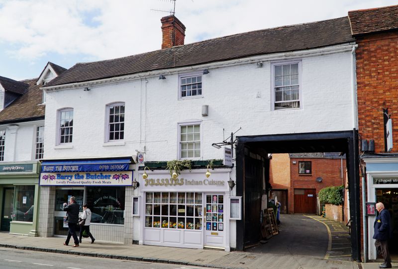
Entry Name: 6 and 6A, Chapel Street
Listing Date: 9 February 1972
Last Amended: 4 April 1994
Grade: II
Source: Historic England
Source ID: 1187773
English Heritage Legacy ID: 366175
ID on this website: 101187773
Location: Stratford-upon-Avon, Stratford-on-Avon, Warwickshire, CV37
County: Warwickshire
District: Stratford-on-Avon
Civil Parish: Stratford-upon-Avon
Built-Up Area: Stratford-upon-Avon
Traditional County: Warwickshire
Lieutenancy Area (Ceremonial County): Warwickshire
Church of England Parish: Stratford on Avon Holy Trinity
Church of England Diocese: Coventry
Tagged with: Building
STRATFORD-UPON-AVON
SP2054NW CHAPEL STREET 604-1/10/31 (North West side) 09/02/72 Nos.6 AND 6A (Formerly Listed as: CHAPEL STREET (North West side) No.6)
GV II
Town house. Early C19 front to C17 building. Timber-frame, exposed to south, with brick front; C20 tile roof with brick stack to rear of ridge. 2 storeys with attic; 4-window range, windows on different levels. Modillioned brick cornice. C20 shop fronts flank high carriage way with paired plank gates. To right of centre a segmental-headed window with 12-pane sash; 1st floor has segmental-headed windows: 2 with sills and 12-pane sashes; to right with 4/8-pane sash and 12-pane sash. 2 lower rear wings with timber-framing. An inn by 1763 until 1774 (the White Bear), and 1806-1853 (the White Horse). (History of the streets of Stratford-upon-Avon: Bearman R et al: Chapel Street: 1974-).
Listing NGR: SP2007854795
External links are from the relevant listing authority and, where applicable, Wikidata. Wikidata IDs may be related buildings as well as this specific building. If you want to add or update a link, you will need to do so by editing the Wikidata entry.


Other nearby listed buildings