Latitude: 51.4432 / 51°26'35"N
Longitude: -2.617 / 2°37'1"W
OS Eastings: 357214
OS Northings: 171755
OS Grid: ST572717
Mapcode National: GBR C3P.4H
Mapcode Global: VH88M.LZCK
Plus Code: 9C3VC9VM+76
Entry Name: Former Toll House to Front of Toll House Court
Listing Date: 8 January 1959
Last Amended: 30 December 1994
Grade: II
Source: Historic England
Source ID: 1202160
English Heritage Legacy ID: 379402
ID on this website: 101202160
Location: Ashton Gate, Bristol, BS3
County: City of Bristol
Electoral Ward/Division: Southville
Parish: Non Civil Parish
Built-Up Area: Bristol
Traditional County: Somerset
Lieutenancy Area (Ceremonial County): Bristol
Church of England Parish: Bedminster
Church of England Diocese: Bristol
Tagged with: Architectural structure
BRISTOL
ST5771 CORONATION ROAD, Bedminster 901-1/44/375 (North side) 08/01/59 No.285 Former toll house to front of Toll House Court (Formerly Listed as: CORONATION ROAD No.285)
II
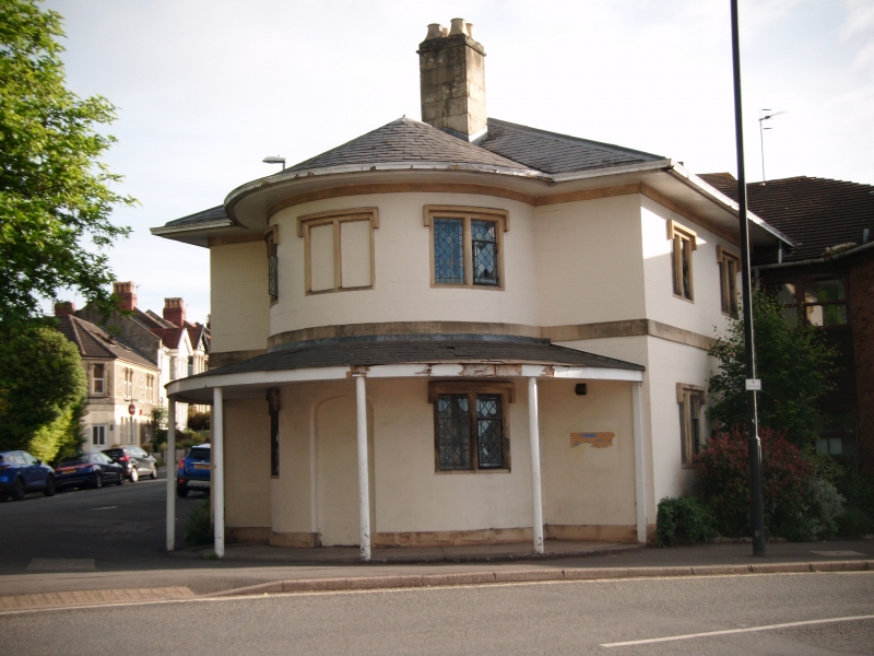
Formerly known as: Ashton Gate Toll House CORONATION ROAD Ashton Gate. House, former turnpike toll house. c1820. Stucco, with freestone dressings and slate roof. Double-depth plan, square with deep curved central bay. 2 storeys; 3-window range to bay, with blank front walls, and 2-window range on both side walls. Low plinth, plat band and deep overhanging eaves of pyramidal roof and tall central stack with 4 moulded pots. Deep, slated verandah to bay on iron stanchions. Blocked central doorway and first-floor window; 2-light windows with square section drip moulds and ovolo-moulded surrounds and mullions. Leaded lights and single light casements. INTERIOR not inspected. The Toll House closed in 1866 and was incorporated c1980 with Toll House Court (not included).
Listing NGR: ST5721471755
External links are from the relevant listing authority and, where applicable, Wikidata. Wikidata IDs may be related buildings as well as this specific building. If you want to add or update a link, you will need to do so by editing the Wikidata entry.


Other nearby listed buildings