Approximate Location Map
Large Map »
Latitude: 52.3368 / 52°20'12"N
Longitude: -2.2911 / 2°17'27"W
OS Eastings: 380262
OS Northings: 271013
OS Grid: SO802710
Mapcode National: GBR 0BZ.HL0
Mapcode Global: VH920.7JNF
Plus Code: 9C4V8PP5+PH
Entry Name: Former Bakehouse East of Rectory
Listing Date: 9 November 1971
Grade: II
Source: Historic England
Source ID: 1217973
English Heritage Legacy ID: 393382
ID on this website: 101217973
Location: Areley Kings, Wyre Forest, Worcestershire, DY13
County: Worcestershire
District: Wyre Forest
Civil Parish: Stourport-on-Severn
Built-Up Area: Stourport-on-Severn
Traditional County: Worcestershire
Lieutenancy Area (Ceremonial County): Worcestershire
Church of England Parish: Areley Kings
Church of England Diocese: Worcester
Tagged with: Architectural structure
STOURPORT ON SEVERN
SO 8071 SW
RECTORY ROAD, Areley Kings (North west side)
589-1/7/94
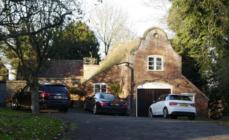
Former Bakehouse east of Rectory
9/11/71
GV II
Bakehouse, now in use as garage. Early C18. Brick with plain tiled roof. Shaped coped gables with small oculus beneath apex and enlarged window above inserted doorway. Later brick lean-to outshut on west side. INTERIOR: Blocked large fireplace on east side with cambered arch. Loft above ceiled.
Listing NGR: SO8026271013
External links are from the relevant listing authority and, where applicable, Wikidata. Wikidata IDs may be related buildings as well as this specific building. If you want to add or update a link, you will need to do so by editing the Wikidata entry.


Other nearby listed buildings
